COLOMBO – The Center for Investigative Reporting (CIR) rolled out its latest investigative reporting initiative on counter-narratives to electoral disinformation and harmful content last week.
The program is a continuation of CIR’s four-year-long program on electoral integrity, an institutional commitment to promote electoral integrity of Sri Lanka.
Under the new initiative, a series of in-depth stories across mediums will be developed over a period of six months by trained journalists and experts.
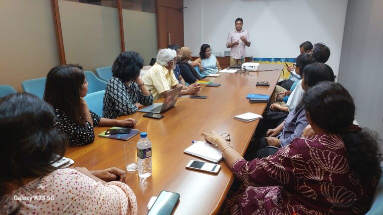
An orientation session was held on 15 July 2025 at the Sri Lanka Foundation, Colombo, to consider media coverage on the 2024 elections and what other areas could have been addressed. Contributors discussed how insights from the3 recent election coverage and issues that remain to be addressed including the delay in holding provincial elections.
The new initiative brings together a select group of CIR Reporting Fellows, activists working on electoral integrity and editors/opinion writers.
The program is supported by Factum Sri Lanka as a part of a broader program on Strengthening Resilience against Disinformation in Sri Lanka.
The South Asian region, which includes India, Bangladesh, Nepal, Sri Lanka, Bhutan, the Maldives, and Pakistan only contains about 3% of the world’s landmass, but hosts 22% of the world’s population, 15.5% of its plant species, and 12% of its animals. Almost 750 million people directly depend on the land for their livelihoods in a region that hosts some of the world’s fastest-growing economies which, in turn, rely heavily on natural resources to power their economic growth.This guide will help journalists answer basic questions such as: what is causing land resource conflicts? what is the scale of its impact? who is impacted? who are the actors involved? and how do their motivations shape these conflicts?
However, the scarcity of land in South Asian countries naturally leads to domestic conflicts between local communities, businesses, the political class, and the administration over the use and ownership of land and its natural resources. These often escalate into conflicts that particularly affect marginalized communities, have clogged the courts, and frozen unprecedented amounts of investment. Sometimes these conflicts also turn violent — people get killed and property destroyed over these issues.
Land conflicts have a broad impact, too. For example, in Bangladesh, research in 2023 showed that just 34 land conflicts centering on about 11,000 hectares (27,200 acres) of land involved more than 51,000 households. In Nepal, while an estimated one quarter of its 27 million people are landless as of 2023, there are 49 land conflicts involving almost 19,000 households centering on almost 6,000 hectares (14,800 acres) of land there.
In Pakistan, land conflicts are widespread, with at least three million people displaced in former Federally Administered Tribal Areas (FATA) facing ongoing disputes over land ownership, often escalating into armed clashes. In 2023 alone, violent land disputes in the Kurram District in northwestern Pakistan led to more than 130 deaths.
Meanwhile, in India, there are more than 900 ongoing land conflicts, involving 10.5 million people and more than 4.7 million hectares (11.9 million acres) of land, affecting investment worth US$411.4 billion, according to Land Conflict Watch, an independent network of researchers who focus on natural resources.
This guide equips journalists with the tools and resources to report on conflicts over land and its resources such as water and forests. Also, this guide will help journalists answer basic questions such as: what is causing land resource conflicts what is the scale of its impact; who is impacted; who are the actors involved; and how do their motivations shape these conflicts. Moreover, it helps journalists to use such information to tell impactful stories.
Why Is It Important to Report on Land Conflicts?
The prevailing class and caste divide in many South Asian countries and sometimes arbitrary rules have led to irregularities in how access and control over natural resources are regulated. This, in turn, has led to extreme concentrations of wealth, which has left a large segment of society without resources or a livelihood, pushing these individuals to the socioeconomic margins, while leaving them increasingly vulnerable to emerging threats such as climate change, food and water shortage, disasters, pandemics, war, and human rights violations.
Reporting on land and resource conflicts gives journalists an opportunity to delve into the root causes that have led communities such as the Dalits — a community outside of the caste system, previously known as “Untouchables” — to end up on the fringes of society.
Definitions and Concepts
While reporting on land conflicts, it is important to understand certain concepts to be able to report accurately, and to use appropriate terminology to avoid any inadvertent prejudice.It is not enough to specify how many individuals or households have been affected by a land conflict. Be detailed. Investigate how exactly it is causing a problem for the community.
Before starting an investigation, journalists should determine the extent of the conflict by examining how many individuals/households have been affected by the conflict and how; whether the land is private or common; and who has the legal rights to the land. Also, try to ascertain how government authorities handle those individuals or communities without legal ownership of land as well as forest dwellers and tribal communities.
What Is Considered a Land Conflict?
A land conflict can be defined as any instance in which two or more parties dispute the use, access, or control over land and its associated resources. A land conflict arises when there is either a demand for, or opposition to, a change in the ownership, access, or use of land. Since the objective of the guide is to report public interest stories, we will be only discussing land conflicts, where at least one of the parties is a community (public). Property disputes between two private parties are not within the scope of this guide.
Who Is Affected?
How critical or significant the land conflict is will depend on how many people have been affected and how. A land conflict can have large repercussions on the communities who reside on the land or depend on it for their livelihoods, for example, communities can be displaced or forcefully evicted. Many of these conflicts involve the acquisition of agricultural land, with one party or more making allegations that their consent to the appropriation of the land was not obtained or that they were unfairly compensated.
When investigating a story, it is not enough to specify how many individuals or households have been affected by a land conflict. Be detailed. Investigate how exactly it is causing a problem for the community: Are people being displaced or evicted? Are they losing their land or their livelihood? Will they be compensated? Is the compensation enough to start again somewhere new?
Online resources like Land Conflict Watch can help reporters identify individual land disputes as well as national-level impacts of these conflicts, across metrics like total number of disputes, population and land area affected, and monetary values. Image: Screenshot, Land Conflict Watch
Private Lands and Common Lands
Private land is land that a private party — an individual or an institution — owns legally.
Common lands are those that are collectively managed and used by communities. These could be grazing lands, community forests, bodies of water, for example, that communities use for habitation, livelihoods, or for cultural or religious purposes. Common lands, in most cases, have no formal ownership titles.
Note that in most countries that have a colonial legacy, “common land” is not a legal term and could be referred to under different names. For instance, there is no single category or classification of land use in India that corresponds to common lands. In land records, such land is often classified as forest land, grazing land (known by different names in different jurisdictions), “gram sabha land,” “gram panchayat land,” “municipality land,” or simply “wasteland” or “government land.” These tenurial records are marred by discrepancies and inconsistencies, and often lack data on the current usage of land, including the traditional rights and practices of communities.
Meanwhile, communities claim ownership over these lands often not by exercising legal rights but traditional rights, for example, when they have been cultivating it for generations without any formal land titles. However, the administration often treats these lands as “government-owned.”
This discrepancy results in land conflicts when the government exercises ownership over a plot of common land and unilaterally changes the use of, and access to, such lands without acknowledging communities’ traditional rights over it. Studies show that the majority of land conflicts arise out of this specific type of conflicting claims.
Encroachment
Encroachment generally refers to the process in which a person occupies another person’s land or property without permission. In Indian statutes, encroachment is often defined as the setting up of temporary, semi-permanent, or permanent structures on another person’s land for residential, commercial, or other use. The courts unequivocally recognize the act of encroachment on both private property and public lands as illegal. Unfortunately, this process also ends up labeling individuals or communities that have traditionally used common land but do not have formal titles to the land as “encroachers.”
Illustration: Siddhesh Gautam for GIJN
For example, this happens sometimes to nomadic communities in India. Generations of these communities have moved from one place to another with their cattle, in search of grazing lands. However, many of these communities were classified as “criminal” under the Criminal Tribes Act by the colonial British government in 1871. After the act was repealed in 1945, these communities became known as “Denotified Tribes,” or DNTs. Even so, these groups have had little protection when it comes to land rights, unlike many other marginalized tribal communities such as those that are part of the Scheduled Castes and the Scheduled Tribes categories under the Indian Constitution.
Whenever these nomads use common land, they claim traditional rights over it. The state, on the other hand, considers them encroachers because they have no legal rights to the land, which the state considers government land. The absence of a title to land or laws to safeguard their interests have left these nomadic communities vulnerable to forced evictions, resulting in homelessness and also criminal prosecution.
As a result, it’s important to be aware that the term “encroachers” could be used to label a party in a land dispute as a way to undermine their claims to the land.
For example, often the media or the government label individuals or communities as “encroachers” even though they may have legitimate claims to the land in question because of traditional rights. It is important that in such cases journalists refrain from using the term “encroachers” and instead use the name of the community.
Tips and Tools
Understand the Nature of Land Resource Transactions
The stories involving land conflicts almost always revolve around a transaction of land or its resources where the access to, use of, or control over the resources change hands from one party to another. A conflict gets triggered when the transactions are forced upon one party or are deemed unfair to it. The conflict could be triggered by a proposed transaction, an ongoing one, or a transaction that occurred in the past. It is important to understand the nature, the timelines, the processes, and the parties involved in these transactions to uncover the real stories.
Break Down the Roles of Various Actors
Typically in land resource transactions, several kinds of actors are involved: Communities/citizens, who are the traditional users, owners, or custodians of land and its resources; businesses, who come in to claim rights over land and its resources; governments, which are the custodians of these resources as well as facilitators and regulators of the transactions involving them; and the arbitrators in cases of conflicts.
It’s important to examine the roles of all parties involved in land resource transactions.
Understand the Regulatory Framework
Before reporting a land conflict story, it is important to understand the regulations that apply to land transactions in a country. Journalists don’t need to know all the granular details of the law, but becoming familiar with key provisions and their implications goes a long way. Lawyers and researchers working on these issues in your country can help.
For instance, the Chittagong Hill Tracts (CHT) Regulation, 1900 that applies to three hilly districts in southern Bangladesh regulates land ownership and use there, requiring special permits for land transfers to non-Indigenous people. It protects Indigenous land rights by restricting land sales without prior approval. In Nepal, the Land Act, 1964, governs land reform, including so called “land ceilings,” which prohibit landowners from holding land beyond a certain amount and mandates government acquisition of excess land for redistribution to landless farmers.
A 2022 rally of Indigenous peoples in Dhaka, Bangladesh, marching in support of their CHT rights and against land grabbing, among other issues. Image: Shutterstock
In India, the appropriation of private land by the government is regulated by the Land Acquisition Act of 2013, which makes it mandatory for the government to obtain the consent of a certain percentage of landowners impacted by the appropriation. It also requires that the government conduct a Social Impact Assessment Study before taking over the land, and ensures compensation and resettlement for the displaced. Similarly, when forest lands are diverted for industrial use, the Forest Conservation Act of 1980 and the Forest Rights Act of 2006 mandate that developers obtain permission from the federal government and obtain consent from the tribal communities residing on the land or using it, while also formally recognizing their land rights before any displacement occurs.
Finding Stories in Violations of the Rules
Often land conflicts occur when policies, laws, or rules are violated, subverted, or changed to benefit one party over the other. Sometimes, the existing regulatory framework is perceived as unfair by some parties to a dispute in protecting their rights.
Case Study: This story by the Centre for Investigative Journalism in Nepal (CIJN) highlighted how an amendment in the country’s forest law allowed private wealthy individuals, including members of the ruling party, to buy land in previously protected areas. The government told journalists that previous laws hindered development and that the changes made were an attempt to redistribute land to the landless.
Another investigation by CIJN reported that local government officials misused a new law giving them the power to issue land titles and transfer ownership, fraudulently selling off individuals’ land without their consent. Those accused denied the allegations.
India’s 2006 Forest Rights Act stipulates that forest land cannot be diverted for industrial or commercial use without first formally recognizing the rights of the forest dwellers and then obtaining their consent. An investigation by IndiaSpend in January 2019 found that this provision was being violated by developers to gain access to forest lands. Local authorities claimed that there were no tribal communities or forest dwellers living in the area, or they issued false certificates claiming that forest rights had already been dealt with and that the project was unopposed. The corporate entities accused of wrongdoing didn’t respond to the reporters’ requests while the government officials claimed they followed “due process.”
Documents and Resources
To illustrate how the rules are being bent or broken, documents and other evidence are essential. Journalists can obtain executive orders, minutes of official meetings, and official correspondence from government departments regarding land resources regulations and transactions using Freedom of Information laws. Court documents such as petitions, affidavits, orders, and judgments can also be helpful in finding information and data, as well as parliamentary proceedings, including question and answer sessions. These can be searched online in most countries.Land record portals are a valuable source of documents for investigating land ownership and property transactions.
For instance, in India, Parivesh, the project clearance dashboard, where environmental approvals for development projects are published by the Ministry of Environment, Forest, and Climate Change, is a great example of an online database where data and documents about land conflicts are stored. Land Conflict Watch is another resource that journalists and researchers can use to access data and documents about land governance. (Editor’s Note: The writer of this guide is the founder of Land Conflict Watch.)
Most governments have now started to digitize land records — ownership deeds, surveys, transaction details — and have started making available the details of land ownership and land transactions online. These land record portals are a valuable source of documents for investigating land ownership and property transactions. For instance, in India, most provinces have online portals where land records and property transaction details for a specific location and for a specific time period can be downloaded. Old maps, revenue receipts for land taxes, even court notices and summons or penalty receipts for encroaching on land have often served as evidence for communities to show historical possession of land, such as in this case of forest land disputes in southern Rajasthan. Journalists should think out of the box and look for such evidence to substantiate their stories.
Use of Satellite Imagery
Satellite imagery can also be a powerful tool for journalists investigating land conflicts, enabling them to visualize disputes with evidence of changes in land use over time. High-resolution imagery, from platforms like Google Earth Pro or NASA’s Landsat, allows reporters to monitor deforestation, encroachment on common land, or shifts in agricultural patterns that often underlie conflicts. For instance, journalists can use historical imagery to document the clearing of forested areas or the expansion of mining operations. Organizations like the European Space Agency and Planet Labs offer resources and tools for accessing satellite data. Additionally, platforms like Google Earth Engine enable journalists to analyze large-scale geospatial datasets, helping them uncover trends and patterns in land-use changes.
By overlaying property maps or “protected forest area” boundaries on satellite images, reporters can reveal realities on the ground. Tools like Mapbox and OpenStreetMap allow for the integration of local mapping data with satellite imagery, adding a layer of context to stories.
Reporting Land Disputes Holistically
Land conflicts do not exist in isolation, they involve a range of other societal issues. Understanding and reporting on these holistically is crucial, as it allows for more comprehensive coverage, reporting that goes beyond surface-level disputes. Here are some key areas where these intersections manifest along with case studies illustrating them.
Land and Politics
Land conflicts often have deep political underpinnings. Politicians may amass wealth by building real estate empires and political parties may exploit land issues for electoral gains, leading to tensions between local communities and state authorities. Reporting on these dynamics can reveal the complex motivations behind land conflicts and highlight the role of the regulatory environment in shaping outcomes.
Case study: In this undercover investigation, Al Jazeera journalists reported on how Bangladesh’s former land minister, Saifuzzaman Chowdhury, allegedly spent more than US$500 million on luxury real estate in London, Dubai, and New York City, but did not declare his overseas assets on his Bangladesh tax returns. Chowdhury said that the funds used to buy these properties came from legitimate businesses he had owned outside Bangladesh for years. As of June 2025, his assets have been frozen by the UK’s National Crime Agency (NCA) and he is under investigation by Bangladesh authorities for money laundering.
The Indian Express investigated more than 2,500 land registries across 25 villages near the Ram temple in Ayodhya. The temple became a major political plank and journalists found a 30% rise in the number of land transactions after the Supreme Court allowed the construction of the temple. According to the Indian Express, many of these deals were allegedly made by family members of politicians and government officials or those closely linked to them across party lines.
The response to these allegations varied amongst the individuals named. Most of them denied any direct involvement in the purchase of land, while others minimized their purchase by stating it was for a school or helping a poor family.
Land and Business
An investigation by Pakistan’s Dawn newspaper documented the illegal expansion of a community beyond its approved borders. Image: Screenshot, Dawn
An investigation by Pakistan’s Dawn newspaper documented the illegal expansion of a community beyond its approved borders. Image: Screenshot, Dawn
The interests of private enterprises often clash with those of local communities, particularly when land is repurposed for industrial or commercial use. Journalists should investigate how business interests influence land transactions and assess the impact of these decisions on affected communities.
Case study: This investigation by Pakistan’s Dawn newspaper focused on alleged financial corruption in the development of Bahria Town, a gated community on the outskirts of Karachi. The story showed how the town had been expanding, violating a 2019 Supreme Court judgment that only allowed the project a specific acreage. It also highlighted how the real estate company hadn’t paid a court-mandated fine. The story used satellite mapping to show where the development had encroached on land outside its approved borders.
In court, the company denied exceeding its development outside the land allotted to it after the 2019 judgment. In April 2025, the National Accountability Bureau (NAB), which was investigating the case, froze the company’s assets and issued arrest warrants for the owner.
Land and Caste
In South Asia, caste dynamics significantly influence land ownership and access. Historically marginalized groups often face additional challenges in asserting their land rights. Understanding these nuances can enhance reporting and bring to light the social injustices that underpin many land conflicts.
Case study: This investigation on the ground in many Indian states found that land titles given to Dalits as part of past land redistribution programs have been rendered ineffective because the original owners, who were members of higher castes, never ceded control over the land.
Land and Technology
As many countries in South Asia strive to digitize their land records, new stories are emerging about land issues and technology. On the one hand, technology can improve transparency in land transactions and enhance services related to land for communities. On the other hand, it can exacerbate inequalities, especially if marginalized groups lack access to digital resources.
For instance, in India, the Digital India Land Record Modernisation Programme is being implemented to digitize, update, and safely store land ownership data across the country. It has led to the purging of hardcopy land records and the modernization and digitization of land governance systems. However, this push to use technology solutions for the country’s land problems has also led to disruptions and an emerging area of conflicts.
Case study: This investigation by Down To Earth found that land records were forged during the digitization process of records in order to take land belonging to Dalits in India’s Madhya Pradesh province.
Land and Climate Change
There are new kinds of land conflicts emerging, which are triggered by “solutions” to mitigate climate change.
Displacement or migration caused by climate change-related disasters, such as floods or droughts, can lead to disputes over land rights and access to resources. Journalists should investigate the existing policies and government action to address the losses of those affected by climate change. For instance, hundreds of thousands of people are affected by floods in India’s Assam province every year, but a lack of compensation or assistance for these people often leads to new conflicts.
While such stories have traditionally been reported, there are new kinds of land conflicts emerging, which are triggered by “solutions” to mitigate climate change. For instance, large-scale renewable energy, carbon offset, green hydrogen, or rare earth metals/minerals mining projects can also lead to land conflicts if their social and environmental impacts are not properly assessed and mitigated.
Case study: This investigation by India’s Article-14 revealed how land conflicts can arise if climate solutions such as critical mineral mining are allowed without consideration of the land rights of communities. In this case, the local government assured the villagers that there was no threat to their land but their village was nonetheless included in an auction for mineral exploration. Similarly, this investigation by Frontline magazine showed how a solar power plant allegedly appropriated the land of several Indian farmers without their consent or any compensation. Officials had claimed that the proposed land area “remained uncultivated and (was) lying vacant.” The company said it had “purchased the land from bonafide land-owners.”
Editor’s Note: Dilrukshi Handunnetti and Miraj Chowdhury contributed to this guide.
Kumar Sambhav Shrivastava is an award-winning journalist, researcher, and social entrepreneur who specializes in innovative research methods for accountability and equity-based reporting. He is the founder of Land Conflict Watch, a data research initiative that tracks land and environmental conflicts in India. In the past, Kumar served as India Lead for Princeton University’s Digital Witness Lab and was an AI Accountability Fellow with the Pulitzer Center. He has written for international and Indian publications.
Are you a researcher, filmmaker, photographer, or digital creator under 35? Apply for the Storytellers Fellowship — a unique chance to document powerful stories of climate resilience, local leadership, and environmental challenges in the Barak-Meghna basin. 🌊🌿
Journalists interested in covering South Asia or the South Asian diaspora can apply for this fellowship.
The South Asian Journalists Association‘s SAJA Reporting Fellowship (SRF) seeks to support in-depth reporting projects focused on South Asia or the South Asian diaspora. The fellowship is open to both freelancers and staff journalists across all media formats.
Each project is eligible for funding between US$2,000 and US$5,000, with a total of up to US$20,000 awarded annually.
Applicants must secure a letter of interest from a U.S. or Canadian media outlet, as the final work must be published, aired or posted online by a North American publication or broadcaster.
Applications are evaluated based on the project’s relevance, originality and potential impact. Preference is given to stories that address underreported issues and offer fresh perspectives on South Asia or its diaspora.
News outlets around the world that collaborate with young people can submit nominations for an award.
The Global Youth & News Media Prize, in partnership with News Decoder, the International Center for Journalists (ICFJ) and others, is accepting nominations for its 2025 Journalism Award. The award seeks to find, celebrate and spread the word about the lessons from the best cases of success in youth-local news media collaborations from around the world.
This year’s Journalism Award spotlights great youth collaborations that contribute to the survival of local news outlets.
Candidates can be self-nominated or submitted by a third-party nominator.
Early-career journalists around the world are eligible for an investigative journalism fellowship.
Reuters and Durham University are accepting applications for the Sir Harry Evans Global Fellowship in Investigative Journalism. The fellowship honors celebrated British-born journalist, editor and author Sir Harry Evans, one of the pioneers of modern investigative journalism.
The annual fellowship will provide the opportunity for an exceptional early-career journalist to receive a nine-month fellowship at Durham University.
During the fellowship, the journalist will undertake an investigative project from inside a Reuters newsroom in London, New York, Sydney or Toronto.
The fellow will also be mentored by top Reuters editors in the field, while being overseen by Durham University and have access to university academics and research resources.
The fellow will receive a monthly salary of GBP4,444 (US$5,929), along with a living stipend and payment for travel and related expenses.
The island nation’s north saw the last phase of a brutal civil war. As war widows and mothers of the disappeared reclaim their land from the conflict, they seek to turn another disaster into a story of resilience.
Santhirasegaram Sivaranjini kneels in the dry soil of her home garden, her hands caked in dirt as she carefully plants seedlings. The sun beats down relentlessly, a reminder of the prolonged drought that has ravaged her land. Around her, the remnants of last year’s failed harvest — withered stalks and cracked earth — tell a story of loss. But Sivaranjini is determined. “This year, I will try again,” she says, her voice steady despite the weight of her struggles.
For the 44-year-old war widow and a mother of three, this small plot of land is more than a garden. It’s a lifeline. She endures the dual devastations of Sri Lanka’s recently concluded 26-year-long civil war and the escalating impacts of climate change.
Sri Lanka’s civil war was a conflict between the Sri Lankan security forces and a separatist group of Tamil minority called the Liberation Tigers of Tamil Eelam (LTTE). In the final stages of the conflict in 2009, the Sri Lankan military ruthlessly bombed LTTE strongholds in the north. The death toll – mostly civilians – is estimated to be up to 100,000. One of the victims was Sivaranjini’s husband, who died from injuries sustained during the shelling of Oddusuddan, a township that witnessed some of the fiercest fighting between the Sri Lankan forces and the LTTE.
Today, the war is over, but not for Sivaranjini.
“This year has been the most devastating,” she tells Asian Dispatch, her voice tinged with exhaustion. “There was no rain during the weeding period, and then too much rain just before harvest. Severe droughts in between. Everything was destroyed.”
Sivaranjini is the sole provider for her home, and her story is not unique. In northern Sri Lanka, particularly in Mullaitivu, Tamil women — many of whom are war widows or survivors of the conflict — are facing the compounded impacts of prolonged droughts and erratic weather patterns.
One of the significant impacts that the conflict has had is the increased number of female-headed households (FHH) in the Northern Province including Mullaitivu district. Out of the 5.2 million households in Sri Lanka, an estimated 1.1 million households or 23 percent of the households are FHH.41. Of that it is estimated that women head 58,121 households in the Northern Province.
For over two decades, the north has experienced drastic climate shifts, with severe droughts rendering vast tracts of agricultural land infertile and torrential rains causing floods. Climate change has robbed these women of their primary livelihood—farming—and forced them to seek solutions for survival.
Oddusudan by Asian Dispatch A time-lapse of Oddusuddan, in Mullaitivu district, highlights how much the landscape changed from 1966 onwards. The landscape shows lush greenery in the late 90s to parched and infertile lands in the 2000s. Video: Rukshana Rizwie; satellite images via Google Earth
Sivaranjini’s family once thrived on farming. Before the war, they earned at least LKR 1,000 (roughly $3) per day, growing black gram, green gram, maize, ground nut, cowpea, sesame, kurakkan, red onion, big onion and soya beans.
But the conflict and its aftermath left deep scars. Her eldest son, who sustained severe fractures during the shelling, requires frequent hospital visits. With no borewells to irrigate her three acres of land, Sivaranjini relies on borrowed water from a nearby well—a precarious arrangement. “If the other landowners see my plants bearing fruit, they won’t let me fetch water,” she says. This makes her increasingly reliant on the rain cycle.
Mullaitivu is located in Sri Lanka’s dry zone, and has long been a hub for growing red rice and other field crops such as groundnut, green gram, black gram and pulses. This is also where the last phases of the civil war were fought.
Over the past few decades, the district has experienced significant shifts in its rainfall patterns, disrupting traditional farming practices and challenging the resilience of its agricultural dependents. Data from 1961 to 2002 reveals a complex picture of climate change impacts, with Mullaitivu standing out as one of the few regions in Sri Lanka where annual rainfall has increased, even as the number of rainy days has declined.
According to academicians Sulakshika Senalankadhikara and L Manawadu, who both teach at the Department of Geography at the University of Colombo, who are co-authors of a study, Mullaitivu recorded an increase in total annual rainfall of 7.215 mm per year over the 42-year period from 1961 to 2002. However, this increase in total rainfall has not been accompanied by a rise in the number of rainy days.
“Mullaitivu experienced a decline in the number of rainy days by 0.818 days per year. This suggests that while the total volume of rainfall has grown, it is now concentrated in fewer, more intense downpours,” Senalankadhikara says, adding that this shift has significant implications for agriculture, as it leads to longer dry spells interspersed with heavy rainfall events that can cause flooding and soil erosion.
For example, the study’s spatial interpolation maps show that Mullaitivu’s rainfall patterns have shifted significantly over the decades. While the district once received relatively consistent rainfall, it now experiences more extreme fluctuations, with periods of intense rainfall followed by prolonged dry spells. This variability is particularly challenging for paddy cultivation, which relies on consistent water availability.
Spatial interpolation maps of Sri Lanka show that rainfall patterns have changed over the years with the district now receiving torrential pours.
According to V Pathmanandakumar of the Department of Geography at Eastern University in Sri Lanka, the land cover in Oddusuddan has undergone significant changes over the past two decades. His research, which produced thematic maps illustrating land-use changes between 1997 and 2016, reveals a troubling trend: A 5.88 square kilometre decline in vegetation cover.
“In 1997, about 453.02 square kilometres of the Oddusuddan division was covered with vegetation,” Pathmanandakumar explains. “By 2016, that figure had dropped to 447.14 square kilometres.”
Legacy of loss in the north
In the north, the story of the climate crisis is closely intertwined with the legacy of loss among the Tamils. Sri Lanka is a Sinhalese Buddhist-majority country, and Tamils form its largest minority, making up 12 percent out of its 23 million population. The community has historically faced systemic discrimination since the country gained independence from British colonisation in 1948. Sinhalese Buddhists have great influence in Sri Lanka’s institutions, including politics, judiciary and police, leading to further marginalisation. Ethnic fissures, compounded by violence and discrimination, eventually erupted into a civil war in 1983, which lasted until 2009. The war is over now, but not for 3.1 million Tamils, who still reel from the impacts of war. Women and children are disproportionately impacted by its outcomes.
Sasikumar Ranjinidevi, who lives 30 km away from Sivaranjini, says the war has left her feeling like a stranger in her own land. Her husband and family members surrendered to Sri Lankan security forces during the final years of the armed conflict. Her kin are now among an estimated hundred thousands of disappeared, with no sign of their return. This left Ranjinidevi to shoulder the burden of raising her children and rebuild their shattered lives alone.
According to the United Nations Human Rights Council Report, Sri Lanka has the second highest number of enforced disappearances worldwide, tipping 100,000 disappearances.
“I see the sorrow etched on my son’s face,” she tells Asian Dispatch. “There are days he returns from school in a solemn mood, refusing meals and weeping alone for hours or even days. He misses his father terribly.”
The weight of her loss is palpable. Yet, Ranjinidevi masks her grief, knowing life must go on. After the end of the armed conflict, she returned to her hometown to reclaim her land and rebuild what was lost. “Our harvests and planting cycles always revolved around the weather,” she recalls. “It was like clockwork. Now, it’s as unpredictable as our lives. Over the years, we’ve abandoned our land, plot by plot. Today, an entire acre lies barren and unusable.”
Ranjinidevi’s lands are vast but her farms are small, she can only grow what the weather allows. Today she is tending to wheat and hopes her vegetables will withstand the next downpour. Photo: Rukshana Rizwie
What little remains of her land tells a story of struggle. Ranjinidevi once grew vegetables in her home garden and pulses in the fields. “Either the seeds drown in excessive rainwater or the crops are washed away before we can harvest them,” she explains. Though the rains are brief, they are devastatingly intense, leaving no chance for recovery.
Knee-deep in debt, Ranjinidevi has borrowed from both private and government banks. “We can’t make enough. Nothing grows, and when it does, it’s destroyed. Whatever I hoped to salvage has been lost. I can’t even pay the interest on my loans. I don’t know what to do, and there’s no one to share my worries with,” she says.
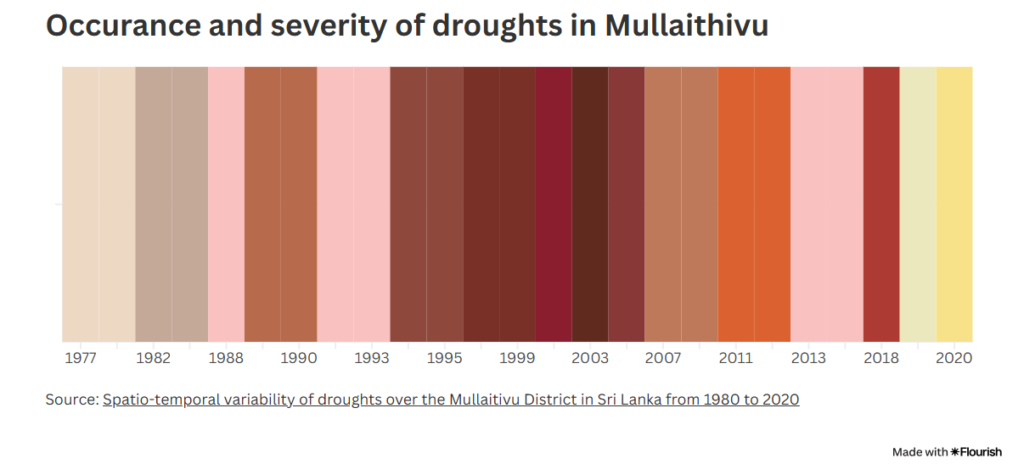
During droughts, the situation worsens. Wells dry up, forcing them to buy drinking water. “The brinjals and pulses I planted withered under the scorching heat and lack of water,” she says with despair. ”There was a time when lorries would come to our lands to load up on onions to take to [capital city] Colombo,” she said. “Today we jump for joy at the sight of a growing single onion.” The dry spells are the hardest to bear, she says. The severe drought in 2018 she and her family experienced, lasted for more than eleven months and affected the western part of the entire district.
She says no matter how much effort or money she invests, the force of climate change is against her. “It isn’t supposed to rain this month (February), but it has been pouring and last year around this time, we experienced floods.”
When is the next big drought?
Based on the research by a group of scientists from Malaysia-based Universiti Sains Malaysia, the next significant drought in Mullaitivu is likely to occur during the southwest monsoon season, which spans June, July and August. Historically, these months have been identified as the driest in the region, with minimal or no rainfall recorded in some years. The study highlights that drought conditions often originate in the western part of the district in March and progressively spread eastward, intensifying during the peak dry months of July and August. This pattern is influenced by geographical factors and the Indian Ocean Dipole (IOD), which has a strong correlation with drought occurrences in the area.
Given the cyclical nature of droughts in Mullaitivu, the southwest monsoon season of 2025 is expected to follow this established trend. The combination of high temperatures, increased evaporation rates, and reduced rainfall during these months will likely exacerbate water scarcity, impacting agriculture and daily life.
The study also notes that the IOD plays a significant role in shaping these conditions, with positive IOD phases linked to warmer sea surface temperatures and reduced rainfall in the region.
A heatmap based on scientific studies conducted in Mullaitivu which shows the occurrences and incidents of severe droughts from 1977 onwards to date. Graphic: Rukshana Rizwie
A struggle for identity and land
To understand the climate crisis for Sri Lanka’s north, one needs to acknowledge the historical role land plays in Tamil identity. The community is believed to have descended from the Jaffna kingdom and are natives to the country. Despite the legacy, the Sri Lankan government listed them as a separate ethnic group and even removed the Tamil language as an official language in 1956 – which was later reinstated in 1987. The Sri Lankan government is also accused of erasing Tamil legacy by destroying archeological evidence of the community’s historical roots. With the Tamil culture, language and history under siege, the LTTE was borne out of the idea of a Tamil “homeland” where LTTE founder V Prabhakaran famously said that the Tamil race is “deeply rooted” to the northern soil. After the war, the Sri Lankan government has been waging a quiet war on Tamil land. Most of it is on agricultural land.
Sasikumar Santhidevi was eight months pregnant when her husband died during the shelling in the war. She fled to save her and her unborn baby’s lives but when she came back in 2011, her land was occupied by the Sri Lankan military. Military occupation of Tamil land became a jarring reality for thousands of civilians like Santhidevi, who returned after the war only to find camps, bases and High Security Zones on their agrarian and familial land. According to the Adayaalam Centre for Policy Research, an advocacy group, the military held 30,000 acres of land in Mullaitivu in 2019, a decade after the war.
For Santhidevi, the military eventually let go of some land but a portion of it is still occupied by Sri Lanka’s Department of Forests.
“[When I came back after the war],I couldn’t locate my home, Santhidevi recalls. “The entire area was a jungle. My mother and my little children took axes and began to cut through the dense shrubbery. I remember one occasion when we were having a meal during a brief respite, the army commander of the area came over and told us to leave everything and go.”
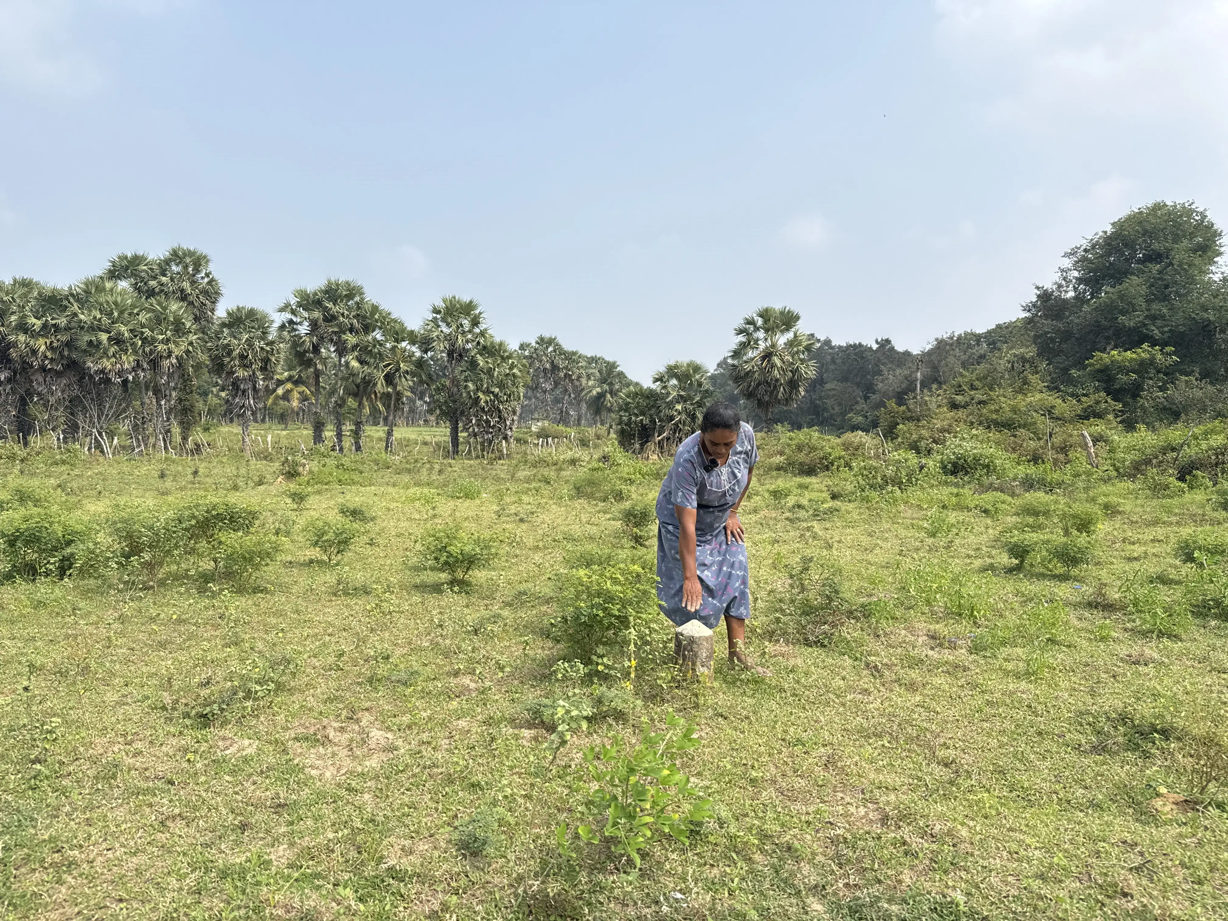
Santhidevi didn’t give up: “We lived on this land and had all the documentation to prove it, so I went to court. The army offered us money in exchange for an acre of land, but we refused. We wanted to keep our land.” Once she was finished dealing with the army, she confronted another issue: The Department of Forests, which still claimed an acre of her land. “We can’t access it to date,” she says, leading us to a spot marked with concrete poles. “They’ve fenced the land, and if we are to go to court over it, we need at least LKR 100,000 ($334) in legal fees, money which we don’t have.”
Despite the Department of Forests’ claim on the land, Santhidevi says she sees them planting and harvesting pulses each year, which they later sell.
Santhidevi shows us the concrete polls that separate her own lands from the rest of the plot. Photo: Rukshana Rizwie
Asian Dispatch investigated the land occupation in Mullaitivu district.
In response to a Right to Information (RTI) petition submitted by us, the Mullaitivu secretariat responded with a calculation that showed a total of 4,859 acres that still remain occupied. Only 2,891.75 acres have been released so far. Of the five divisions in the Mullaitivu, Karaithuraipatru (Maritimepattu) is the most heavily occupied. Over 4,000 acres of the total occupied land fell within this division.
Division
Total seized by tri-forces
Land Released (acres)
Land Remaning (acres)
Karaithuraipatru
6809
2764
4045
Thunukkai
429.25
0.25
429
Oddusuddan
188
2
186
Puthukudiyiruppu
284.5
115.5
169
Manthai East
40
10
30
Total
7750.75
2891.75
4859
Keppapulavu is where hundreds of residents – including Santhidevi – were forced to flee their homes during the final stages of the war in 2008. Soon after, the military took control of more than 202 hectares of Tamil-owned residential land, incorporating the former residents’ homes into vast military camps. The army now uses the land for farming and maintaining guarded military camps, despite promising that they’ll return the land as part of the government’s justice, peace and reconciliation process.
The RTI petition also revealed that Sri Lanka’s Forest Department has expropriated 32,110 acres of land, while the Wildlife Department continues to lay claim to 23,515 acres. The Sri Lankan military, at the same time, continues to occupy large tracts of state and private land in Mullaitivu, estimated to be 16,910 acres, according to a research by the Oakland Institute researchers.
Although the government claims that the military has released 90 percent of occupied land in the Tamil-majority north, a Human Rights Watch report last year found that this figure was impossible to verify as there was “no publicly available accurate and comprehensive mapping of land occupation”. The Adayaalam Centre for Policy Research estimates that the military still occupies 12,140 hectares of land in Mullaitivu alone.
A Google Maps search shows several key military institutions scattered across Mullaitivu, including the Sri Lankan Air Force base and station, the Sri Lanka Army barracks, the security forces headquarters, a military barracks next to the GE Office, the 6th Battalion Sri Lanka Electrical and Mechanical Engineers base, the 9th Sri Lanka Army Signal Corps, and the Mullaitivu army base hospital.
A simple Google map search reveals just a few of the military installations and camps dotted along the main roads in Mullaitivu. Screenshot: Google Maps
At the same time, the Sri Lankan Army has commercialised the agricultural land in question, by selling the produce to landowners. The military has been running commercial projects such as resorts and shops in high-security zones, which prevents the resettlement of displaced Tamils. For example, Valikamam North in Jaffna district is approved for resettlement, but large military camps and bungalows remain on private land, and access to many areas continues to be restricted.
A time-lapse video showing how the area around Mullaitivu has changed since 1965. Graphic: Rukshana Rizwie
In 2023, the Sri Lanka army admitted that several of its battalions had been stationed on private land, occupying 70.05 acres of private land. Many of these military companies are not even pinned on a map to be easily identified or located.
Images on the Sri Lankan army website show its military personnel engaging in farming. Photos: Army.lk
Building a new life, one garden at a time
Pulasthi*, a war survivor who requested anonymity, expressed exhaustion from monitoring the Sri Lankan army’s occupation of two acres of her Keppapulavu farmland. She recounted fleeing with her husband and two children to Mullivaikkal during the war’s final phase. While taking refuge in Mullivaikkal camps, her husband and eldest son were killed by a shell that struck their camp. The army forced her to leave her home in 2009, moving her to Manik Farm. Manik Farm was a military-run displacement camp, which recorded several human rights violations. Pulasthi was there until 2012, when the site was shut down and its residents relocated to another camp in Sooripuram. Pulasthi was given a new house in another village but returning to her land in Keppapulavu isn’t allowed.
“The land I’m on isn’t mine,” she says. “It’s only 40 perches. I used to have two acres [in Keppapulavu] where we farmed and lived comfortably. This land is barren. We have no electricity, and I can’t make ends meet.”
Today, in a parched home granted to her, Pulasthi finds solace in her home garden, where she’s planted chillies and palm trees. What she lacks is irrigation as her plot of land is situated at a lower elevation, which makes it vulnerable to flooding during rainfall. “Either the water is too salty or it evaporates too quickly,” she claims. “I pray to God it rains soon.”
Pulasthi looks out at the expanse of land beyond the confines of her humble home. Photo: Rukshana Rizwie
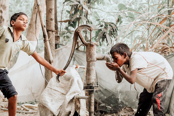
Daily life often revolves around accessing clean water from wells and nearby tanks. Now, rising salinity levels, exacerbated by droughts and saltwater intrusion, is making this increasingly difficult. The consequences are far-reaching: Water resources are under immense strain. Major reservoirs experience fluctuating water levels, minor irrigation systems dry up rapidly, and streams flow irregularly. Just like Pulasthi described, the groundwater sources are depleting, and water quality is declining due to high salinity.
Compounding these physical vulnerabilities is the district’s low socioeconomic resilience. With a disaster resilience index of less than 30 percent, Mullaitivu residents struggle to cope with and recover from climate shocks. Poverty, limited income diversity, low financial inclusion, and inadequate social protection systems leave communities ill-equipped to face long-term challenges. The result is a cycle of hardship that undermines well-being and hampers recovery efforts.
“We live because dying isn’t a choice,” she says, her voice steady but her eyes betraying the weight of her struggles. “What can I do? I’m cornered in this piece of land that isn’t mine. We grow and eat whatever we can and live for the sake of our children.”
Sivarasa Rajeshwari, a war widow with four children, says that agricultural resilience is the only hope for Tamil women. The 46 year old had fled the war to Puthukudiyiruppu, a small town in Mullaitivu, and was displaced several times without money or belongings until she came back home to reclaim her land – and sustenance. “Growing vegetables not only feeds my family but also brings in a little extra when I sell them at the market,” she says. In 2018, the worst drought in memory wiped out her entire harvest. “I’m grateful it was only that year,” she says, her relief tempered by fear. “I pray we never see a repeat of it.”
Despite the erratic climate, Rajeshwari says it’s necessary for women like them to adapt. “Only certain vegetables can survive these conditions,” she explains, gesturing to a field of eggplants. “Thankfully, I have a well with a motor to pump water to the plants. Before, we carried water in buckets for each plant —it was exhausting.”
Rajeshwari inspects her eggplants to ensure the leaves are not infected with pests. She tells us that she has a few more weeks before she can harvest them. Photo: Rukshana Rizwie
Despite the hardships, the resolve of the women in Mullaitivu remains unshaken. For Sivaranjini, the path forward is clear.
“I will keep working,” she says, her hands returning to the soil. “This land is all I have.” Her words echo the quiet determination of a community that refuses to be defeated, even as the odds stack higher against them.
In the face of war and climate change, women’s resilience is a powerful reminder of the human capacity to endure and adapt. Amid the rubble of loss and the scars of conflict, new life sprouts in the women’s home gardens, a testament to hope and perseverance.
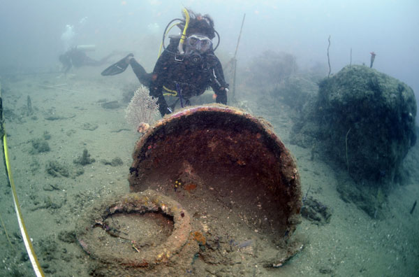
Sri Lanka’s waters are home to over 200 shipwrecks, each holding a unique story of trade, war, and maritime heritage. Among the most significant are the Godawaya Shipwreck, which dates back over 2,000 years, and HMS Hermes, the world’s first purpose-built aircraft carrier built by British and sunk by Japanese dive bombers during World War II (1931-1945).
Over time, these shipwrecks have transformed into artificial reefs, supporting marine biodiversity and playing a crucial role in ocean ecosystems. However, climate change is now emerging as a major threat to their survival, potentially shortening their lifespan.
“Shipwrecks face multiple threats from climate change,” says Prof. Sevvandi Jayakody of the Department of Aquaculture and Fisheries at Wayamba University of Sri Lanka. “These include extreme weather events, ocean acidification, invasive species, and rising sea temperatures, all of which can accelerate the degradation of wrecks.”
Marine archaelogists exploring Godawaya shipwreck2. Pic courtesy Maritime Archaeology Unit of Sri Lanka
Sri Lanka is increasingly vulnerable to extreme weather events, with storms becoming more intense due to climate change. A literature review published in the Sri Lanka Journal of Economic Research highlights a significant rise in tropical cyclone intensity in the Bay of Bengal between 1981 and 2010, a trend scientists attribute to higher sea surface temperatures. Other studies suggest this intensification has continued over the past two decades.
“More intense storms and cyclones generate powerful waves and strong currents that can impact shipwrecks, specially those in shallow waters,” explains Dharshana Jayawardane, a researcher of shipwrecks for over two decades. “Even after heavy monsoon seasons, we’ve seen cases where shallow-water wrecks suffer damage due to rough seas. If storm intensity increases, the risk to these wrecks will only grow.’’
Strong waves also shift sand and sediment, exposing previously buried wrecks to deterioration or burying them deeper, which can hinder archaeological research and conservation efforts, he said.
Diving tourism
Human-induced climate change, driven by greenhouse gas emissions such as carbon dioxide (CO₂), not only warms the planet but also increases ocean acidity when the ocean absorbs carbon dioxide from the atmosphere, which lowers the ocean’s pH.
“Globally, research has shown that ocean acidification speeds up the corrosion rate of iron and steel wrecks,” notes Prof. Jayakody. “This is especially concerning for wrecks like HMS Hermes, which may still contain live ammunition. As the metal weakens, there is a risk of explosive materials being exposed.”
Another alarming consequence of corrosion is the potential release of bunker oil from sunken ships. If intact fuel tanks begin to leak due to rapid deterioration, it could cause secondary environmental pollution, further harming marine ecosystems.
Although ocean acidification studies in Sri Lanka are still in their early stages, the National Aquatic Resources Research and Development Agency (NARA) is monitoring pH levels in coastal waters.
“We take regular measurements from stations on both the east and west coasts,” says Dr. Kanapathipillai Arulananthan director general of NARA. “Additionally, the Norwegian research vessel Nansen is expected to provide further insights into changing ocean parameters in the Northern Indian Ocean.”
Another hidden threat is the rise of invasive species that could now establish in different areas due to warming waters. Changes in ocean temperature and acidity alter microbial activity, leads to faster decomposition of wooden shipwrecks according to research.
“Wooden wrecks are particularly vulnerable to wood-boring organisms like shipworms, which thrive in warmer conditions,” warns Prof. Jayakody. “As ocean temperatures rise, these organisms could spread to areas where they previously could not survive, accelerating the breakdown of historical wrecks.”
Ballast water from ships can introduce these invasive species to new environments. While differences in salinity, temperature, and acidity once prevented their survival, climate change is making new habitats more suitable for these species, increasing the risk of bioerosion.
Beyond their historical importance, shipwrecks serve as artificial reefs, providing shelter and breeding grounds for marine life. However, climate change threatens their ability to sustain biodiversity. Rising sea temperatures can lead to coral bleaching and degradation, weakening the ecosystem surrounding wreck sites.
Sri Lanka has experienced several significant coral bleaching events over the past few decades, mainly due to higher sea temperatures and other environmental stressors. 1998 Mass Bleaching Event that was triggered by a strong El Niño effect , led to the destruction of over 50% of some coral reefs in Sri Lanka. Another substantial bleaching occurred in 2016, causing extensive coral damage. Sri Lanka is frequently experiencing heat waves, so more such coral bleachings are expected.
Also, stronger storms and shifting currents could damage or bury shipwrecks, leading to habitat loss for marine organisms. Combined with disruptions in food chains and breeding patterns, these factors pose a significant risk to the stability of these underwater ecosystems according to Prof. Jayakody.
With shipwrecks spanning ancient, colonial, and modern eras, Sri Lanka holds a treasure trove of global maritime heritage.
According to Rasika Mutukumarana of the Department of Archaeology, about 40 shipwrecks in Sri Lankan waters are of significant historical value. However, the full extent of he impact of climate change on these wrecks are still unknown.
“These changes can be slow but significant,” Mr Mutukumarana explains. “Long-term monitoring is crucial to assess and mitigate damage, but securing funding for such research remains a challenge.”
Prof. Jayakody echoes this concern, emphasising the unpredictability of climate change’s effects on shipwrecks. “We may not even have seen the full extent of these impacts yet. Biological changes triggered by global warming could bring consequences we haven’t even imagined. That’s why continuous monitoring and conservation efforts are essential to safeguard this invaluable maritime heritage.”
As climate change intensifies, Sri Lanka’s shipwrecks face an uncertain future. Without proactive measures, these historical and ecological treasures could deteriorate beyond recognition, taking with them invaluable insights into the past —and a crucial refuge for marine life in the present.
Mr. Mutukumarana said every shipwreck is unique and when one disintegrates so goes its story, too. The only way forward would be to reduce the rate of global warming.
This story was produced under the CIR- CANSA Media Fellowship Programme.It was originally published in The Sunday Times on 30 March 2025.
Although the annual school sports events concluded without major incidents this year despite the rising heat, the traditional Aluth Avurudu games — once a source of joy for children — now warrant extra caution in the face of a changing climate.
In March 2024, sixteen-year-old Vidurshan, a student from Ampara in Eastern Sri Lanka, collapsed midway through the inter-house marathon event. He died in hospital.
The post-mortem by the Judicial Medical Officer, issued an open verdict, but the signs were clear that the student faced a heat stroke-related illness.
This tragedy unfolded during one of the hottest months Sri Lanka has experienced in recent times.
“Many factors can contribute to heat stroke, but high environmental temperature is the dominant cause,” said Dr. Lal Ekanayake, director general of the Institute of Sports Medicine, highlighting the dangers of outdoor physical exertion in extreme heat.
Deaths during sports events or physically demanding activities are often attributed to heart issues. However, these cardiac events can themselves be triggered by high temperatures, noted Dr. Ekanayake.
“When the body is stressed by heat, the heart rate increases to regulate internal temperature. But heavy sweating leads to loss of vital minerals and electrolytes, disrupting heart signals and potentially causing heart arrhythmia — one of the leading causes of sudden deaths during sports,” Dr. Ekanayake told Sunday Times.
What makes Vidurshan’s case even more tragic is that it could have been prevented. Just weeks before the event, the Education Ministry had advised schools to postpone sports meets until late April due to soaring temperatures. Such warnings are not new. Over the past five years, the ministry has issued heat stroke alerts to schools during the hot season on four occasions .
“We issue these heat stress warnings considering the recommendations we received, but regional-level decisions are permitted based on the severity of heat experienced in each area,” says Sujatha Kulendrakumar, deputy director of education at the Ministry of Education.
In Sri Lanka, the districts most affected by extreme heat are in the Dry Zone and parts of the Intermediate Zone. Areas such as Anuradhapura, Polonnaruwa, Trincomalee, Batticaloa, Ampara, Vavuniya, Mannar, Monaragala, and Hambantota often record the highest temperatures in the country and it is expected that global warming will make things particularly worst for these areas.
“Children hardly get time to play outdoors anymore, and now even that is affected by the heat,” lamented retired civil servant Indrasena Muthukumarana, 82. “In our time, we were always outside playing or engaged in other activities at our leisure times, but the heat never bothered us like this.” Mr Muthukumarana’s observations are backed by scientific evidence. A World Bank report titled ‘The Impact of Climate Change on Education and What to Do about It’ published last year reveals that a child born in 2024 will face twice as many wildfires and tropical cyclones, three times more river floods, four times more crop failures, and five times more droughts in a warmer world than a child born in 1970.
The rising heat is not only a threat to physical safety but also to education as the World Bank Report also highlights that extreme heat can lead to learning losses. While small shifts in average temperatures might seem negligible, they accumulate over time — especially in already hot regions — resulting in significant setbacks in education. Performance on exams drops noticeably on hotter days, disproportionately affecting students in poorer, less-equipped schools, the publication stated.
Extracurricular activities like physical education, sports, and field trips are frequently canceled during heatwaves, further impacting children’s holistic development, which has become common in this part of the world according to this report.
In Sri Lanka, many rural schools lack fans or air conditioning. “Heat in classrooms on some days become unbearable, so high temperatures lead to fatigue and lower alertness,” noted Science teacher Suneetha Ramanayake. “Not just students – teachers, too, feel the heat which affects total quality of the teaching.
Conditions could be worse in tuition classes, as some are held in makeshift huts with tin-sheet roofs. Such premises turn into ovens under the midday sun. Even electric fans can’t offset such intense heat, Ms Ramanayake said.
The current hot weather is expected to last until May, until monsoon winds start to sweep across Sri Lanka warns, Dr. Anusha Warnasuriya, a forecasting director of the Meteorology Department. While average temperatures in Sri Lanka have increased only slightly, it’s the combination of heat and humidity that makes the situation dangerous. “When there’s high humidity, sweat doesn’t evaporate easily, so the body can’t cool itself — from February to May, limited wind and cloudless skies make things worse.” said Dr. Warnasooriya.
To alert the public, the Department of Meteorology of Sri Lanka uses a Heat Index Advisory system. This system calculates the apparent temperature by factoring in both the air temperature and relative humidity, offering a more accurate reflection of how hot it feels to the human body. Warnings are issued using a colour-coded system, ranging from green for normal conditions to dark red for extreme danger, where heat stroke is imminent.
A recent UNICEF report showed that in 2024, heat-related events became the most significant climate hazard disrupting education globally, affecting an estimated 171 million students. In Asia, the highest disruptions were in April, with heatwaves impacting at least 118 million children.
Sri Lanka is highly vulnerable to climate change and has consistently ranked among the countries most affected by extreme weather events, being ranked No 2 in the Global Climate Risk Index of 2019. The country has already experienced a temperature rise of about 0.8 to 1.0°C, and projections indicate a further increase of 1.0 to 1.2°C by 2030, potentially reaching up to 4°C by the end of the century under high-emission scenarios.
Even after the school sports season ends, risks remain. April also brings traditional Avurudu games such as marathons and bicycle races held at the village level. “We’ve recorded deaths during these games, too,” said Dr. Ekanayake.
To address the issue, Sri Lanka issued a set of guidelines particularly for event organisers of sports events, also covering heat-related illnesses. These guidelines include being in close contact with nearby hospitals for emergencies and ensuring events start early to avoid the peak heat. “Don’t delay the start waiting for politicians or chief guests — it’s safer to begin before the sun gets too harsh,” Dr. Ekanayake advised.
As Sri Lanka faces increasingly extreme weather, it is crucial for schools, communities, and policymakers to adapt and prioritise the safety and well-being of children — both in sports and in learning, Dr. Ekanayake said.
This story was produced under the CIR- CANSA Media Fellowship Programme. It was originally published in The Sunday Times on 30 March 2025.
Climate change-related weather events prove to be an increasing challenge for most districts of Sri Lanka including Kalutara
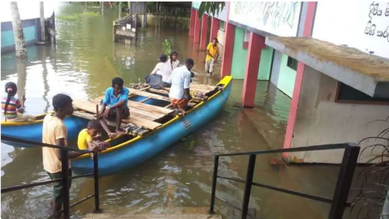
The rain poured down heavily, turning narrow roads into muddy streams. Ten-year-old Dineth held his mother’s hand tightly as they watched the water rise near their home in Agalawatta in Kalutara. His schoolbag, packed and ready, lay untouched by the door. “No school today,” his mother sighed. It was not the first time. Every time the floods came, Dineth and his friends stayed home, missing lessons, exams, and the joy of being with schoolmates.
Rain is no longer just a minor disturbance for the Kalutara District; it has become a force severely impacting the residents’ lives. Floods submerge homes, schools, and livelihoods several times a year, leaving in their wake, much more than material losses. Friends and neighbours, once a community of support, are now scattered as families scramble, looking for safe dwellings during regular flooding events. With floods occurring a few times each year, community bonds are at risk, as is children’s education.
The 2018 Global Climate Risk Index report, first highlighted the extent of Sri Lanka’s vulnerability to climate change, identifying the island as one of the highly affected countries with regard to extreme weather events. It assessed the impacts of extreme weather for two decades, from 1998 to 2017.
With a population of around 22 million, Sri Lanka’s population grows at an annual rate of 1.1%. According to experts from several sectors, nearly 50% of the population is highly vulnerable to climate change-related impacts, particularly flash floods.
A closer look at the Kalutara District, which has a notably wet climate with abundant precipitation – recording over 2,880 millimetres (mm) of rainfall per year – reveals its vulnerability to climate change.
The first Biennial Transparency Report of Sri Lanka’s Climate Secretariat, which was submitted to the United Nations Framework Convention on Climate Change last year (2024), identified changing rainfall trends in Sri Lanka. It noted increasingly erratic rainfall due to climate change, with both South-West and North-East monsoons showing variability that results in excessive rainfall or extended dry spells.
The 17 experts who prepared the report identified the doubling of flash floods in the Kalutara District since 1990, attributed to the increased intensity of inter-monsoon rains. They also anticipate a 5-10% decrease in the annual rainfall in the dry zones and an increase in extreme rainfall events in the wet zones, to which the Kalutara District belongs, by 2030.
Kalutara’s increasing vulnerability
The Kalutara District’s rainfall trends support concerns raised in the said report, showing how extreme weather is already shaping its future.
‘Spatial Variability of Rainfall Trends in Sri Lanka as an Indication of Climate Change’, a research published in the International Journal of Geo-Information further highlights the island’s climate related vulnerabilities. A researcher with the International Water Management Institute with a focus on remote sensing and disaster risk Niranga Alahacoon, and a Professor in Engineering Physics at the Department of Physics, University of Colombo Mahesh Edirisinghe, have examined the spatial variability of rainfall trends in Sri Lanka from 1989 to 2019.
The study highlights the considerable increase in annual rainfall across all climatic zones – wet, dry, intermediate, and semi-arid. The wet zone recorded the highest increase in rainfall, while the semi-arid zone recorded the least. This suggests that Districts in the wet zone are at a higher risk of floods. During the considered period, the Kalutara District recorded the highest average annual rainfall of 3,340.2 mm including the highest maximum annual rainfall of 4,489.4 mm in 2019.
A trend analysis conducted by them using Kendall’s tau value – a non-parametric measure of the strength and direction of a monotonic relationship between two ranked variables – and Sen’s slope – a non-parametric method to estimate the slope of a trend line – shows that while rainfall has generally increased across all Districts between 1989 and 2019, Kalutara recorded the highest annual rainfall, with an increase of 34.84 mm per year. Further analysis of the Southwest monsoon rainfall trends showed a significant rainfall increase in seven wet zone districts – Kalutara, Colombo, Gampaha, Galle, Matara, Ratnapura, and Kegalle. Kalutara recorded the highest rainfall during the Southwest monsoon, increasing at 21.943 mm per year.
The Meteorology Department Director Anusha Warnasooriya, who holds a Doctor of Philosophy degree in climate studies, told The Daily Morning: “Rainfall in Sri Lanka is increasing. Our average annual rainfall typically ranges between 1,800 mm and 1,900 mm. In recent years, including 2024, it has exceeded 2,000 mm. The variability of rain is also high. For example, in 2024, rain has been heavier than predicted, with increased intensity, sometimes delivering a month’s worth of rain in just two days. Such extreme events are becoming more frequent due to climate change.”
The rising trend of extreme rainfall in Kalutara is not merely statistical; it is a reality that impacts the residents’ lives each year. As scientific studies highlight the steady increase in rainfall, disaster records show the human cost of these extreme weather events.
Statistics from the National Disaster Relief Services Centre (NDRSC) from 2016 to 2024 show repeated flooding incidents in Kalutara impacting 148,580 families (582,489 individuals) and being responsible for 40 reported deaths. In 2016, floods impacted 4,563 families (16,458 people) and killed six. The following year (2017), the situation worsened, with 48,889 families (183,835 people) being affected, with 17 fatalities. The subsequent year 2018 saw 7,438 families (28,876 individuals) impacted with no lives lost.
In contrast, 2019 marked the worst year, with 61,301 families (255,964 people) affected with one reported death. In 2020, the floods impacted 1,599 families (6,255 people), killing two. In 2021, 4,318 families (16,482 people) were affected, and five lives were lost. The floods slightly receded in 2022, affecting 1,759 families (6,817 individuals) with one fatality. In 2023, 2,430 families (8,971 people) were affected, with two deaths reported. In 2024, floods once again tore through communities, forcing 16,283 families (58,831 individuals) to flee their homes and claimed six lives.
Disaster prone
A resident of the Kithulgoda Grama Niladhari Division in the Kalutara District, Ashoka Swarnalatha recalls the loss of her neighbours in a 2017 landslide. The family next door – a mother, father, and daughter – was buried when the floods triggered a collapse. “I’ve been living here for over 50 years. When I was young, flooding wasn’t a problem. But now, it rains almost every day. Small streams we played in as children have turned into raging waters that overflow. That year, the rain didn’t stop, and my neighbours were gone in seconds in a landslide. We were like one family. We cooked together, shared food, and looked out for each other.”
Pathma Priyanthika used to live in Ihala-Kudaligama, a village where her family had lived for over 80 years. It was a place untouched by floods or landslides, even in the days of their grandparents. In 2014, two families, including theirs, had to flee, fearing the risk of rain-induced landslides. The house that formed their family’s foundation for generations was no longer safe. Now, living 20 kilometres away, they have lost touch with childhood friends, relatives, and neighbours. She says: “It was a lifetime of memories that we had to leave. We left everything familiar, from the trees that we planted as children to the neighbours who felt like family. Our children had friends there, a school that they loved, and a place that they belonged to. Now, they struggle to adjust in a new place. Our business, which we built with so much effort, had to be rebuilt from scratch.”
Meanwhile, Disaster Management Centre (DMC) Director – Awareness Pradeep Kodippili said that the relevant authorities including the DMC are currently working to develop early warning systems related to natural disasters including floods, and to strengthen social welfare systems to support vulnerable populations. He says that there are plans to reduce morbidity and mortality from extreme weather events by establishing warning systems using the latest technology, carrying out timely risk assessments, and improving health preparedness.
Disruption to school education
According to the Education Ministry, the Kalutara District has 419 schools, including 50 in Category 1AB (Grades One-13 or Six-13 with all three curriculum streams for the General Certificate of Education [GCE] Advanced Level [A/L]), 66 in Category 1C (Grades One-13 or Six-13 without the science stream for A/L), 162 in Category Two (classes up to the GCE Ordinary Level), and 141 in Category Three (Grades One-Five or One-Eight). Frequent flooding in the District severely impacts students, teachers, and parents, with unavoidable school closures due to floods disrupting education.
The Kudaligama Maha Vidyalaya, located in the Bulathsinhala Divisional Secretariat Division of Kalutara, is one of the many schools that face disruptions due to flooding. Every year, the school is forced to close for nearly five days when heavy rains make it impossible for students and teachers to attend. In 2024, apart from the regular holidays announced by the Education Ministry, students were given an additional four days of holidays due to floods.
School Deputy Principal Pushpa Ranjani told The Daily Morning: “Our school has 274 students. When I first started working here, there were occasional floods, but they were mainly caused by the low-lying road next to the School. Later, the road was raised, and for some time, the problem disappeared. But now, despite the improved road, flooding has become more frequent again. It rains so often that even a short downpour of one or two hours can make the main road unusable. On such days, students and teachers have to take longer, more expensive routes just to reach school.”
When other roads are also affected by flooding, she says that students and teachers are left with no way to reach school, forcing it to close. She noted that over the past five years, the school has had to grant around 25 extra days of holidays due to floods.
Although the Education Ministry has instructed schools to hold compensatory sessions to cover teaching activities missed due to flood-related school closures, teaching professionals charge that the approach is ineffective.
Ceylon Teachers’ Union President Priyantha Fernando told The Daily Morning that these sessions are usually scheduled on Saturdays or Sundays. However, since most students attend extra classes on weekends, participation in compensatory sessions remains very low. He also noted that the arrangement disrupts both students’ and teachers’ personal commitments.
Education Ministry Secretary Nalaka Kaluwewa said that the number of school days has already decreased due to crises such as the Easter Sunday terror attacks, the Covid-19 pandemic, and the economic crisis, and admitted that making up for the lost time is not easy. “It takes time, but we plan to recover to some extent by next year (2026). By then, exams and school terms can be scheduled as they were in the past. When another disruption like flooding occurs, it becomes even harder to recover. The only option that we have is to hold compensatory sessions on Saturdays or Sundays. We cannot prevent natural disasters, and right now, this is the only solution. Whether it works or not is a question, but there’s no alternative.”
This story was produced under the CIR- CANSA Media Fellowship Programme. It was originally published in The Morning on 13 March 2025.
Al comparar casinos en línea, teniendo en cuenta la variedad de juegos, pensando en un uso regular, una plataforma que puede revisarse de forma independiente es chicken subway juego , mientras una revisión independiente también puede abarcar la experiencia móvil y la navegación, junto con las reglas de retirada y los límites antes de registrarse.
Vor der Entscheidung, welche Seite näher geprüft werden soll, beim Vergleich von Navigation und Bedienkomfort, als Teil eines unabhängigen Vergleichs, eine Option für den direkten Vergleich ist fugu casino 5 , separat kann man auch betrachten die aktuellen Aktionsbedingungen, zusammen mit den wichtigsten Bedienungsdetails ohne die endgültige Wahl zu überstürzen.
Før man beslutter hvilken side der bør undersøges nærmere, ved vurdering af mobil brug, fra et praktisk brugerperspektiv, en platform der kan vurderes uafhængigt er https://spinlander-casino.dk/ , mens en uafhængig vurdering også kan omfatte registrerings- og verifikationsprocessen, med kundesupportens tilgængelighed i tankerne uden at forhaste den endelige beslutning.
Dla użytkowników zestawiających kilka platform jednocześnie, z uwzględnieniem metod wpłat i wypłat, na potrzeby wstępnej oceny, jednym z punktów odniesienia może być kasyno na prawdziwe pieniadze jeśli jednocześnie ocenia się najważniejsze warunki korzystania z serwisu, wraz z zasadami dotyczącymi wypłat w ramach szerszego porównania podobnych serwisów.