IPS is offering an exceptional opportunity for two journalists to develop an understanding of climate change justice. The finish will run from March to July 2025 and will include six module capacity-building courses in understanding climate justice finance, using data and visuals for storytelling, using artificial intelligence for reporting and researching, and telling complex stories for a broad audience and so enhance understanding and develop trust in the media.
Candidates will be expected to produce six features during this fellowship that will use the lessons learned during capacity building. Fellows who complete the course and submit publishable features will have the opportunity to attend a major climate conference where they will be able to hone their skills and build their knowledge and contacts.
Each fellow will receive a stipend for the duration of the program.
Preference will be given to candidates who report on rural communities and in geographic areas seldom covered by the mainstream. We are also looking for candidates who haven’t had the opportunity to attend a major climate conference. Candidates should have at least two years’ experience and be proficient in English, although English doesn’t have to be their mother tongue.
Please send your resume, two samples of your work, and a motivation to ipsassignments1@gmail.com before March 20, 2025.
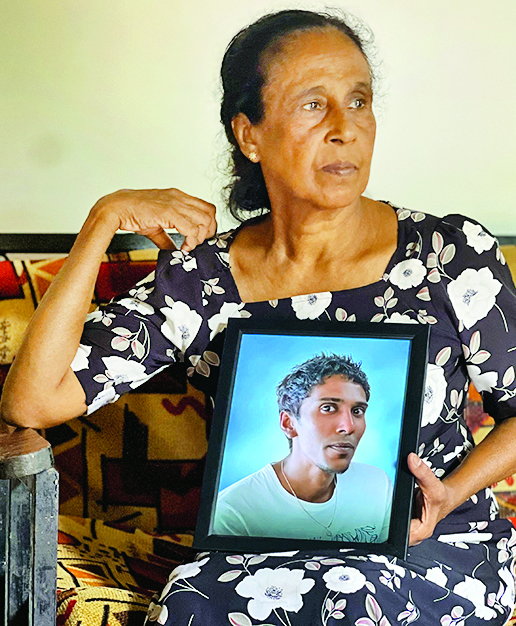
Three-year-old Nethmi Sehansa* from Dematagoda, a suburb of Colombo, succumbed to dengue in May 2023. Her parents and elder siblings remain devastated by her untimely demise. Even though they had big plans for their little daughter, the dengue endemic shattered their dreams.
The Western Province of Sri Lanka had been identified as a high-risk Medical Officer of Health (MOH) area since 2010 with a high density of dengue infected patients. As of March 1, 2025, as many as 4119 cases have been reported from the Western Province, which is the highest recorded number of patients among nine other provinces in the country. The fact that many dengue cases have been reported during a usually low peak season has raised concerns among health officials.
As of March 1, 2025, as many as 4119 cases had been reported from the Western Province
Western Province of Sri Lanka had been identified as a high-risk Medical Officer of Health (MOH) area since 2010
Increasing evidence also suggests that peak dengue seasons may stretch due to unseasonal rains and warmer temperatures
Surge in dengue cases
Dengue is a viral infection transmitted following the bite of infected Aedes species of mosquitoes. According to the National Dengue Control Unit, dengue has a seasonal transmission with two peaks occurring with monsoon rains between June-July and October-December respectively.
Usual symptoms of dengue fever include high fever, pain behind eyes, severe headache, nausea, vomiting etc. Little Sehansa had had high fever and her parents took her to the hospital on the second day. The doctor had asserted that her platelet count was low and advised her parents to admit her to the hospital. Unfortunately, the doctors couldn’t save her life.
Since the beginning of 2023, the National Dengue Control Unit (NDCU) in Sri Lanka has reported 36,628 dengue cases. These figures are around three times higher than the cases reported during the same period in 2021 and 2022.
A 2024 research conducted to investigate reasons behind the outbreak of dengue in 2023 explains the fluctuating incidence of dengue fever that occurred in Sri Lanka since 1989. The largest outbreak due to dengue was reported in 2017 with 186,101 cases, associated with the cosmopolitan strain of the dengue virus (DENV) serotype 2. DENV-2 continued to be the predominant circulating serotype until October 2019. In Sri Lanka, the number of cases began to gradually increase from June 2022 onwards with a total number of 89,799 cases reported in 2023, with 18,650 from Colombo equivalent to one fifth of the caseload. Usually, Sri Lanka has two seasons of intensified dengue activity coinciding with the monsoon seasons. One season typically spans November to early February and the second season runs from May to July.
According to Dr. Preshila Samaraweera, Consultant Community Physician at the NDCU, the endemicity of the dengue virus has increased since 2000. “Therefore the number of cases cannot be brought down to zero even during a drought period. Due to the tropical climate the incidence of dengue is high and there is high transmissibility,” said Dr. Samaraweera.
More rain also creates more stagnant water bodies and receptacles that mosquitoes may breed in – Daily Mirror
When asked why there had been a sudden spike of dengue cases during the pre-monsoon period in 2025, Dr. Samaraweera said it cannot be described as a surge in cases because a similar trend had been observed during the past few years during the same period.
Dengue vector and climate change
But increasing evidence also suggests that peak dengue seasons may stretch due to unseasonal rains and warmer temperatures.
More rain also creates more stagnant water bodies and receptacles that mosquitoes may breed in. Three of the four stages of the mosquito life cycle take place in water – eggs are laid in pools of stagnant water, which hatch into larvae and pupae which develop within them.
A 2020 research on climate change induced vulnerability and adaptation for dengue incidence in Colombo and Kandy explores how numerous models have predicted that climate change would increase the geographic distribution and potential risk of dengue incidence.
Relative humidity is a vital factor, which directly enhances the feeding frequency, inter sexual attractions and oviposition rates of Aedes mosquitoes. The adult longevity and survival success after being infected by DENV have also been found to increase under high humid conditions leading to a wide geographical dispersion of dengue.
Colombo – A high risk MOH area
As for the Colombo district, a combination of factors make it a highly vulnerable area for dengue fever. A study on the impact of environmental factors on the spread of dengue fever in Sri Lanka reveals that dengue fever incidence was caused by following factors: precipitation, wind, urbanization, land management, socio-demographic characteristics.
Consequently, western province possessed higher dengue cases (41% in 2017) than the eastern parts of the country (7% during the 2017 outbreak).
A 2024 research on dengue dynamics and environmental impact indicates that in Sri Lanka, the tropical climate, marked by seasonal weather primarily influenced by monsoons, fosters optimal conditions for the virus to spread efficiently. This heightened transmission results in increased per-capita vector density. Dr. Samaraweera further said that every year 45-50% of cases are always being reported from the Western Province of Sri Lanka. “Out of 57 MOH areas in the Western Province, a high number of cases are often being reported in areas such as Nugegoda. The reasons are manifold including high population density, flash flood situations after a heavy rain that would usually increase the number of stagnant water bodies and most importantly the lack of a proper solid waste management system,” said Dr. Samaraweera.
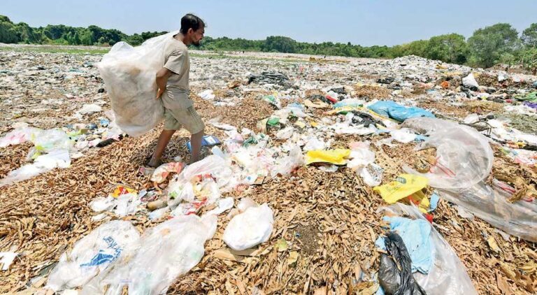
She said that potential breeding sites for the dengue vector include discarded items such as yoghurt cups, coconut shells etc., mostly found in the backyards of houses and commercial buildings.
Speaking about changes in weather patterns over the years, Dr. Lareef Zubair, Principal Scientist at the Federation of Environment, Climate and Technology, observe some ‘unusual rain events’ in dry seasons thereby delaying wet seasons at times. It appears that the frequency of such extremes has changed.
The endemicity of the dengue virus has increased since 2000. Therefore the number of cases cannot be brought down to zero even during a drought period. Due to the tropical climate the incidence of dengue is high and there is high transmissibility – Dr. Preshila Samaraweera, Consultant Community Physician at the NDCU
“Certainly, the temperature highs, the air quality highs and evaporation has been exacerbated due to the already observed climate change. The argument that the warmer atmosphere has the capacity to hold much greater amounts of water vapour is sound and when large clouds burst it can lead to extreme rainfall,” said Dr. Zubair who had been observing weather patterns over the past 15 years.
He further said that people are experiencing a hydrological change. “Both maximum and minimum temperature is higher than in the last century. As a result, evaporation is much higher. Sri Lanka experiences lower air quality, which influences rain formation and the acidification of rain,” he stated.
Dengue infection and non-economic losses
So far, the dengue infection has claimed four lives during the first two months of 2025. In 2024, dengue claimed the lives of 24 individuals. Dr. Samaraweera further said that by reducing the number of cases, it would also save the expenses borne in treating patients with dengue. “When a patient is diagnosed with dengue, his or her economic productivity drops for three weeks. On the other hand the intensity of the infection varies from person to person. Therefore as the apex body to control dengue infections, we carry out targeted interventions such as fogging activities, source reductions and so on,” she added.
A 2014 study done on the economic cost of non-fatal paediatric dengue cases indicate that the average cost to hospital per case of dengue haemorrhagic fever (DHF) and dengue fever (DF) was SLR 24,856 (US$ 191) and SLR 10,348 (US$ 80) respectively.
Sehansa’s case is a classic example which indicates that dengue infection affects individuals irrespective of age. Other non-economic losses associated with dengue fever includes potential long-term health complications and psychological impact on caregivers.
However, the NDCU has been taking various measures to bring down the frequency of deaths by dengue. Dr. Samaraweera said that compared to 72 deaths in 2023 the number of deaths were brought down to 24 by 2024,” she added.
According to WHO, improper water storage practices and high population density are risk factors for dengue. But even though the authorities are taking steps to bring down the cases of dengue, V. Chithra, Sehansa’s mother, claims that even though fogging activities are being conducted by authorities on a regular basis, none of those interventions could save her daughter. “Fogging alone isn’t enough. If you check around these flats, the drainage systems are blocked and there are many stagnant water bodies. People aren’t interested in cleaning their sewage lines or cleaning the surroundings because poverty is a bigger burden they have to face on a daily basis,” she added.
In her comments, Dr. Anoja Dheerasinghe, Consultant Community Physician at NDCU said that there’s no stigma attached to the dengue infection unlike for diseases such as tuberculosis and HIV. When asked whether the urban poor is more vulnerable to the dengue infection Dr. Dheerasinghe said that people in highly populated areas are more vulnerable. “The population density in underserved settlements is high and the mosquitos’ flight range is between 100-200 metres. Therefore chances of an outbreak is highly likely in these areas and people therefore have to take all precautions,” she underscored.
The temperature highs, the air quality highs and evaporation has been exacerbated due to the already observed climate change. The argument that the warmer atmosphere has the capacity to hold much greater amounts of water vapour is sound and when large clouds burst it can lead to extreme rainfall – Dr. Lareef Zubair, Principal Scientist at the Federation of Environment, Climate and Technology
According to the newly drafted National Strategic Plan for Prevention and Control of Dengue – 2024-2030, Sri Lanka has made a commitment to reduce dengue deaths to zero by 2030. The authorities are determined to bring down the average infection rate by 40%. But whether increasing risk factors such as climate change and the adaptability of the dengue vector would pose significant challenges in reaching this target, remains a doubt.
*Child’s name withheld on request from parents under conditions of anonymity
This story was produced under the CIR- CANSA Media Fellowship Programme. The It was originally published in Daily Mirroron 06 March 2025.
With overcrowding, more than double the capacity, and dire states, Sri Lanka’s prisons have become a ‘living hell’ for inmates, while some don’t make it out alive.
The death certificate states that Rajitha Suranga Dissanayake died from heart failure due to pneumonia in the lungs on 26 June 2024, at the Ragama Hospital. He was 35.
“They killed my son. He would still be alive if they listened to him and took him to the hospital on time,” Carmen Liyanage, 62, said. She still can’t believe she won’t hear her son’s voice again.
“I can’t accept this. He can’t be gone,” she said, sobbing uncontrollably, as Rajitha’s eight-year-old daughter watched on.
Rajitha was detained by the Special Task Force (STF) on 17 December 2023, in an anti-drug operation. Days after, he was sent to the Dumbara prison complex in Pallekele.
While awaiting his case to be heard, Rajitha was transferred to the Mahara Prison in Ragama for an earlier case of possessing a phone within the prison complex, which resulted in him travelling nearly 130 km every other week between Mahara and Pallekele. During this period, his health deteriorated.
According to Carmen, he was caught with the phone while he was in Pallekele Prison, in 2023, after he was arrested for possession of drugs. He was released from prison in August and was rearrested in December.
“I went to see him every month after his arrest. He was healthy till June last year,” Carmen said.
During one of her visits on 21 June 2024, Carmen found that her son was having chest pains. Days later, on 25 June, they returned to see him when they heard that he was gravely ill.
“My son was crying when he spoke with us that day. He was weak and could barely speak. He said a prison guard told him, ‘ubala merenna inna aya thamai. Malla aran enna’ (you are all going to die. Bring your bag.).
Later, Rajitha was rushed to the Ragama Hospital around midnight on the prison bus where he died.
Carmen blames prison officials for negligence leading to the untimely death of her son.
Chathura Deshapriya, 43, who was with Rajitha during his last days in prison echoed Carmen’s sentiments. Now released and recalling the ordeal, Chathura said he urged prison officials to take Rajitha to the hospital. His pleas fell on deaf ears. Later, Chathura heard the news that Rajitha had died.
“Rajitha said he would die on the bus. He asked prison officials not to take him, but they (prison officials) put handcuffs on him and took him to Mahara Prison. That night, someone came from Mahara to our ward. He asked, “When Rajitha Ayya left, was he swollen?” We said that he was not. This inmate told us when Rajitha entered from the gate, he was swollen. His fingers were swollen, and he looked very fat.”
Chathura and other inmates were concerned about Rajitha, but that same night they received the news that he had died.
According to a Court report, on 26 June 2024, Mahara Prison warden Sanjaya Prabath Ekanayake gave the following statement, “On 25.06.2024, I reported for duty at Mahara Prison. At around 2:00 in the morning, I was told that I had a duty at Ragama Hospital. Accordingly, I came to the hospital. The suspect had already been admitted to the hospital. He was being treated in the emergency ward. Artificial respiration was given. Later, at around 3:30 in the morning, the doctor informed me that he had died. I informed Mahara Prison by phone. After staying in the ward for about two hours, the deceased’s body was brought to the mortuary.”
The Court report also lists acute myocardial infarction, severe coronary artery, and bronchopneumonia disease as causes of death. The conditions reflect the symptoms Rajitha had days before his death.
Rajitha’s wife, Monica Erandhi, 31, tries to be strong for her daughter. “No one has loved me as much as he (Rajitha) did. If you ask me how I feel now that he is gone, I don’t have words to explain what I feel,” she said.
The Court report, quoting the post-mortem report, stated that Rajitha had two tattoos depicting the name MONICA on both his hands.
Like Rajitha, at least 377 inmates died between January 2023 and December 2024 while detained in prisons, a Right to Information (RTI) request to the Department of Prisons disclosed.
In 2024 (from 1 January to 28 November), 168 inmates died within Sri Lankan prisons. While most of the deaths (155) were reported as due to illnesses, nine inmates are reported to have committed suicide, two died by assault and 2 in fall accidents.
Prisons Department Spokesman and Prisons Commissioner Gamini B. Dissanayake said most of the prisoners who died of illnesses had contracted them before incarceration.
“Another reason is old age. We have over 600 prisoners over the age of 60,” adding that prisoner deaths have decreased in 2024 due to the reduction in the number of incarcerations.
Commissioner of Prison Administration, Ajith Basnayake, said that the basic rights a person has apply to incarcerated persons. Sri Lanka also follows the Nelson Mandela Rules that outline the minimum standards within prisons.
“In the headquarters, there is a separate Deputy Director who is in charge of health. In addition to that, there are prison hospitals. In some prisons, even if there is no hospital, there is a ward and doctors visit them. A doctor must attend to a prisoner when needed,” Basnayake said, adding that this happens as soon as possible.
However, overcrowding within prisons has severely disrupted the system. As of 21 November 2024, the Department of Prisons reported there were over 28,000 inmates, despite the prisons’ capacity being around 10,000. Alarmingly, nearly 19,000 are unconvicted inmates.
Senaka Perera, lawyer and President of the Committee for Protecting Rights of Prisoners (CPRP) said one of the main issues he has observed is that prisoners don’t receive timely medical attention, while inmates have also died due to assault by prison officers. About five of his cases are due to negligence within prisons.
Perera said that the health of prisoners should be a top priority for prison officials. “Outside the Welikada Prison, you see the statement ‘prisoners are human beings’ written on the wall. They must act on it,” he said.
He said that even though Rajitha had a criminal history, prison officials should have ensured that his basic rights were maintained.
A prisoner who wished to remain anonymous said despite the pledge by the Prisons Department to treat inmates humanely they are treated ‘worse than animals’ and prisons are like ‘living hells’.
“Inmates are packed in overcrowded wards. Sometimes we don’t even have a place to sleep. Some people keep standing, in the night, because there is no space to even lie down. We stay like dogs,” he said.
He said an inmate who was in a ward in Dumbara Prison (Bogambara) died by suicide last year.
“He did not have a place to sleep. He stood in the bathroom for days before he hung himself,” the inmate said.
The death of an inmate was verified through information obtained through an RTI regarding prisoner deaths. The report stated that an inmate died by suicide on 4 May 2024, in Bogambara A3.
“Prison officers beat inmates for sport too,” the inmate said, adding that many have signs of depression, but they don’t get treatment.
“We get access to water for 2-3 hours. Seventy inmates have to use water and save up for drinking within that short period. Sometimes, we don’t even have water to drink,” he said, adding that many fear speaking out fearing retaliation from prison officials and the Police.
A 2020 report by the Human Rights Council of Sri Lanka states ward conditions fall short of accepted standards for space per prisoner, ventilation, lighting, and temperature, often resulting in inhumane living conditions and the primary reasons for this include not only the overcrowding prevalent in nearly every facility but also the dilapidated state of the prisons, many of which were built decades ago.
“There is a severe shortage of medical infrastructure and supply of specialised medicine inside prison hospitals, thereby limiting the options for treatment available inside the prisons and requiring prisoners to be transferred to the General Hospital for diagnosis and treatment,” it further stated.
A report by the Department of Prisons titled ‘Prison Overcrowding’ states if courts expedite the hearing of these cases, the process of releasing or convicting inmates could be accelerated. It adds that currently, many suspects are held in prisons for prolonged periods without any form of rehabilitation, and this not only creates numerous issues within the prison system but also results in a significant waste of the country’s labour and financial resources.
In Digana, each day is a battle for Carmen. She cries every time she wakes up and remembers that her son is gone.
“He was the man of the house since his father died. He loved me so much. My life is not the same without him,” she said.
Attempts were made to contact Mahara Prison officials for comment.
The Story was Originally Published in Ceylon Today on 01 March 2025.
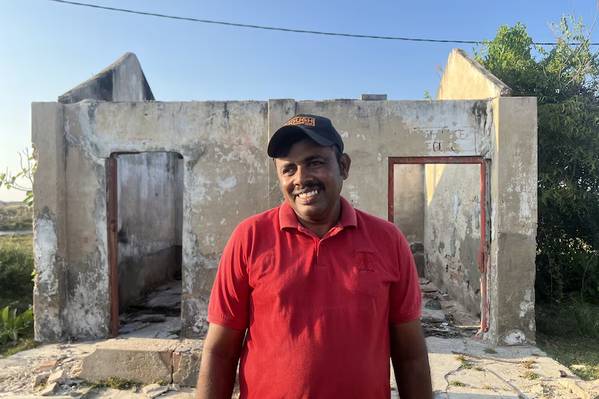
Vinisious Obrey Fernando, 42, points at a map of Keerimundalam, a village located on Kalpitiya peninsula in north-western Sri Lanka.
“This is where my father’s house used to be,” he said.
“Now our house and most of that land has gone to the sea.”
His face wore a sad smile.
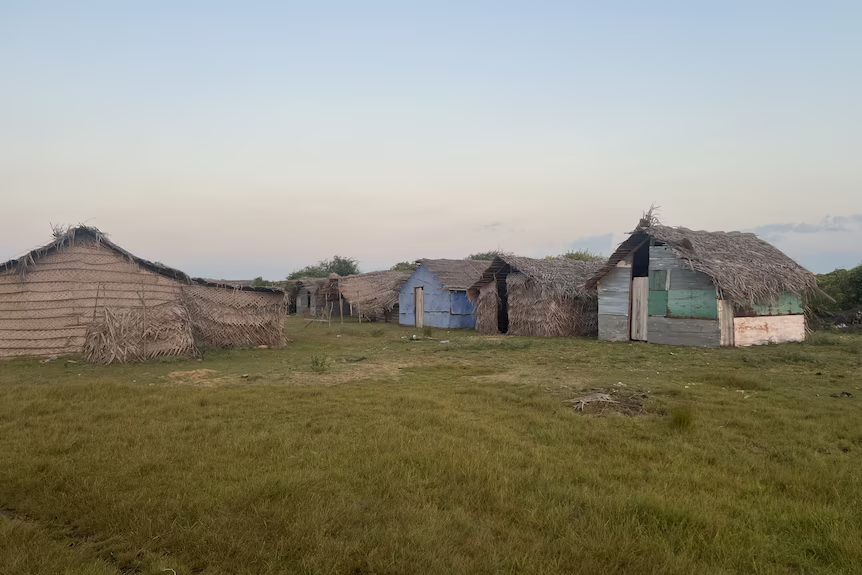
About 20 years ago, Mr Fernando’s village was a tranquil coastal haven with a thriving community of nearly 300 families living in cadjan houses.
It had a school, a post office, and a church more than 210 years old. Now, with the land swallowed by the encroaching sea, Mr Fernando could only reminisce about what once was his family home and vibrant neighbourhood.
In 2014, he and his family relocated to Kalpitiya town area, with a population of around 96,000, like most of his neighbours as their village became uninhabitable.
Vinisious Obrey Fernando stands in front of his father’s old post office.(ABC Asia: Aanya Wipulasena)
The map depicting the grave reality of the situation shows over 90 per cent of his land has been lost to sea erosion. He only managed to salvage parts of the roof and doors of the house as the water rose.
By mid-2024, Mr Fernando could still see the last remaining wall jutting out of the water.
By the time of the publication of this article, Mr Fernando’s father’s house was completely washed away.
During the low tide, he can stand where his father’s house once was.
“That was the house my two siblings and I grew up in. I used to play volleyball and elle, a popular bat and ball game in Sri Lanka, with my brother on the land in front,” he said.
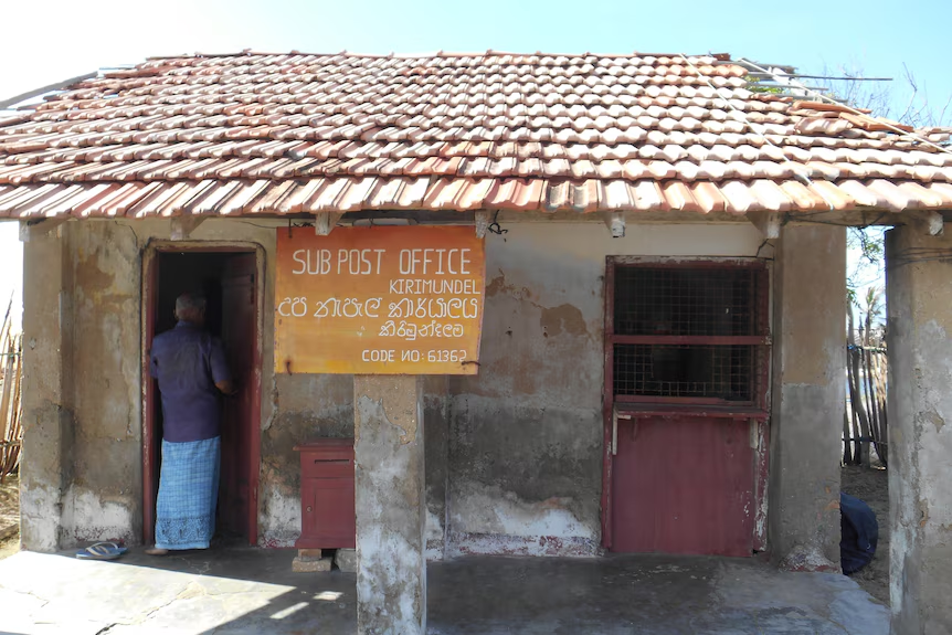
“We used to catch fish in the sea. My father was the village sub-postmaster, and I even met my wife there.”
How the old post office used to look before being damaged by the encroaching sea.(Supplied: The Coast Conservation Department)
On the weekends, the coastal village (Keerimundalam) is eerily deserted.
“This village used to be filled with chatter and laughter. Our friends and relatives have all left now. I feel very lonely sometimes”, said local resident Mekala Santhanal Peiris.
“Will the rest of the village also go into the sea? This is all I think about. I am scared we will lose everything we have.”
Mekala Santhanal Peiris says all her relatives and friends have left the village.(ABC Asia: Aanya Wipulasena)
Ms Peiris moved to Keerimundalam about 20 years ago after her marriage. When the water kept rising, she said, the villagers did everything they could to save it.
With the help of the church and villagers, they built a monument for Sinthathiri Maatha (Lady of Good Voyage), whom the villagers believed would save the village from the sea.
However, now, the sea engulfs the monument’s base when the tide is high.
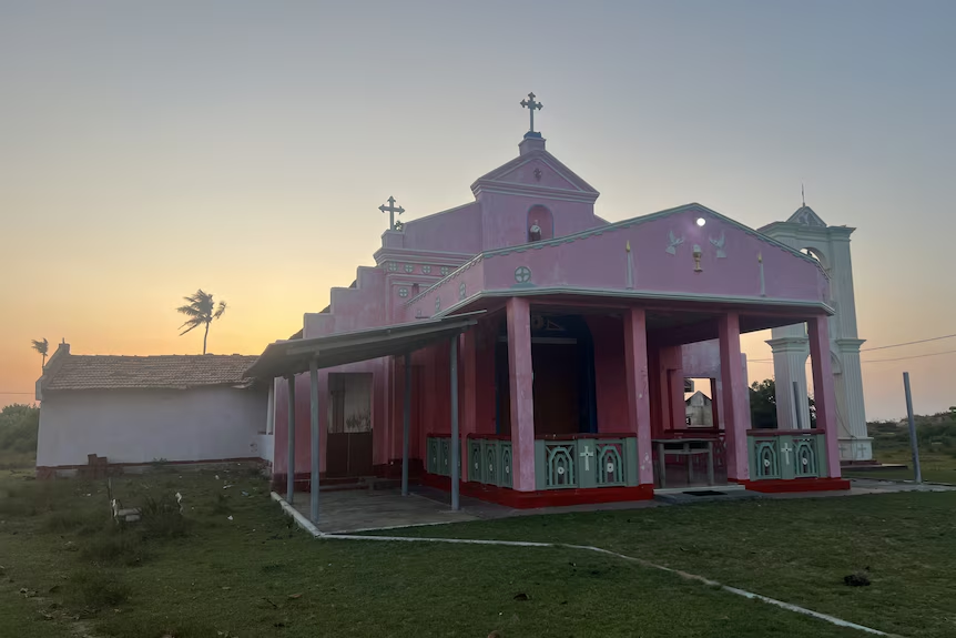
Villagers fear that soon the sea will claim the Holy Cross Church. (ABC Asia: Aanya Wipulasena)
As the sea continued to claim the land, Mr Fernando and other villagers tried to stop by stacking sandbags, to no avail.
The president of the Uchchamunai, Velankanni Matha Rural Fisheries Organisation, Sebastian Dias, said the sandbags were placed two years ago.
“That plan was a failure. Now even the sandbags are in the sea,” he said.
For villagers like Ms Peiris, Mr Fernando and Mr Dias, this is not just about the loss of property; it’s the erosion of a way of life which was deeply rooted in the rhythms of sea, community, and spirituality.
The profound loss of their homes and lifestyle carries a heavy weight. Most of their neighbours and loved ones have relocated to Kalpitiya town.
“During the church feast, the whole village celebrated, and when there was a funeral, the whole village mourned. That has all changed now. Now we don’t even know who died,” Mr Dias said.
“The sea took away our identity from us”.
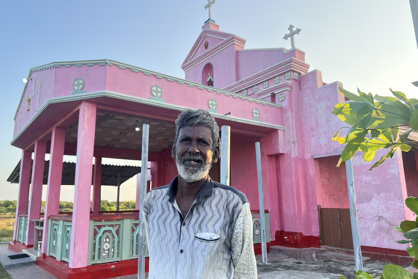
The Holy Cross Church of Keerimundalam is over 210 years old.(ABC Asia: Aanya Wipulasena)
Father Sampath, who has been serving in the Kalpitiya Peninsula for 15 years, said the village church, Holy Cross Church, was important to Keerimundalam and surrounding villages.
With its long-standing history and spiritual presence, the Holy Cross Church brings villagers together.
“During the church feast, which we have in the second week of September every year, almost 3,000 people come to the celebrations. It is a big function,” Father Sampath said.
“Now the sea is near the church. So many houses in front of it are gone to the sea.”
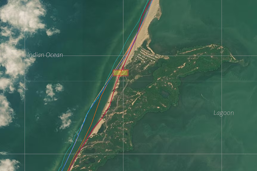
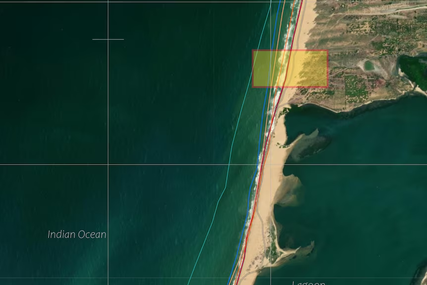
A recent comparison by Geographic Information System (GIS) experts between a survey plan made in January 2005 and a high-resolution satellite photo reveals there is nearly no land left.
A satellite image of Mr Fernando’s land depicting shore erosion from 2005 (light blue line) to 2024 (dark red line).(Supplied: Construction Technological Services)
A 2023 study highlighted that wave climate data from the area shows significant morphological changes, meaning that there are alterations observed in the shape, structure, and features of the coastal line, while intensified wave climate, especially during the south-west monsoon, leads to slow erosion of the Kalpitiya peninsula.
Another study, also in 2023, found that the island’s western coast shows high vulnerability as a result of fewer coastal barrier ecosystems, meaning that most barrier-effective coastal ecosystems in the area have already been degraded and removed.
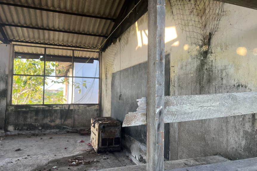
Inside the village school, now abandoned.(ABC Asia: Aanya Wipulasena)
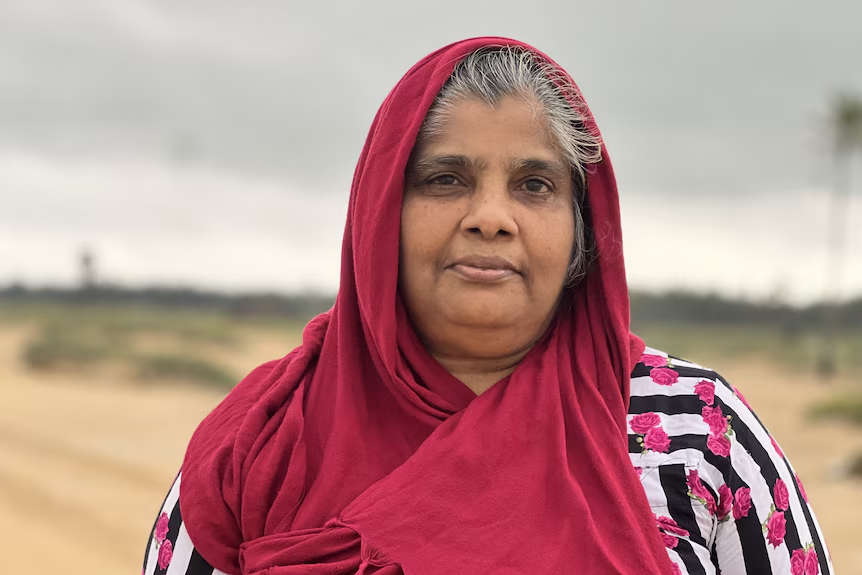
Seinulabdeen Haleema, 59, strolls along the sand with her two grandchildren. A light rain forces the children to find refuge as Ms Haleema takes out her umbrella.
Closer to the seawater, to her right, a once-thriving plantation of mangroves withers, and to her left, further inland, barren stumps of coconut trees punctuate the landscape. She remembers well what the coastline looked like in Kalpitiya decades ago.
“Can you imagine, we used to play on the sand there?” she said, looking into the sea.
Seinulabdeen Haleema stands on her father’s land, where she once played with her siblings. Now, the sea has claimed it.(ABC Asia: Aanya Wipulasena)
Her father bought land in Muhuttuwaram, Dutch Bay, about 40 years ago. They had a mud-thatched house, now claimed by the sea, where her grandparents used to live.
“We were seven siblings in the family. We came to this land on my father’s bullock cart. It was a joyous time,” she recalled.
The land she stood on now, she said, is unrecognisable. It was abandoned. Ms Haleema rarely makes the journey to visit it.
A satellite image of Ms Haleema’s land depicting shore erosion from 2005 (light blue line) to 2024 (dark red line).(Supplied: Construction Technological Services)
D.T. Rupasinghe, chief engineer at the Coast Conservation Department, has been studying erosion in the Kalpitiya peninsula.
“This is Sri Lanka’s most sensitive area due to its geomorphology. It is very dynamic with big variations”, he said, adding that years of research have shown that the islands in Kalpitiya are eroding and shifting landward.
Mr Rupasinghe said that changes in wind patterns, wave patterns, and changes in current were causing the shift.
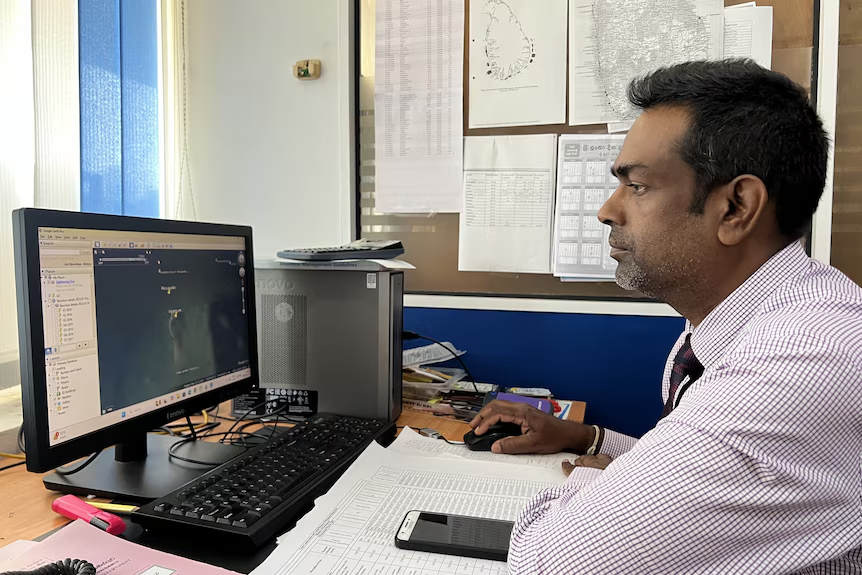
D.T. Rupasinghe studies a Google Earth map of the Kalpitiya Peninsula in his office.(ABC Asia: Aanya Wipulasena)
“We know that these changes are driven by climate change, but we need a database and run numerical models to make that connection. We don’t have the resources to do that,” he said.
He pointed out that human activities and natural changes in the environment also contributed to aggravating sea erosion in Kalpitiya.
The Coast Conservation Department is planning to use geo-bags to stop sea erosion in the Kalpitiya Peninsula following the villagers’ request. However, officials are concerned that it would worsen the situation rather than help.
The Intergovernmental Panel on Climate Change (IPCC), in its sixth assessment report, projects a likely global mean sea level rise of up to 1 metre by 2100, relative to the beginning of this century, under a very high emissions scenario.
The report also presents a low likelihood, high-impact storyline where the global mean sea level rise (relative to 1995-2014) could be up to 1.6m by 2100, further increasing up to 4.8m by 2150.
Roshanka Ranasinghe, Professor of Climate Change Impacts and Coastal Risk and member of the expert scoping team for IPCC, said it was essential that detailed studies were done in coastal hotspots to see what adaptation measures were necessary.
“I recommend authorities look at the results of global trends and identify areas that are vulnerable and have a big impact on the economy,” he said.
State authorities are both aware and concerned about the situation. The director of the country’s Climate Change Secretariat, Leel Randeni, agreed there was a need for real-time data.
“There is some research on sea erosion, [but] there are many gaps that need to be revisited”, he said, adding that though Sri Lanka is not a major carbon emitter, it was among the most affected countries by climate change.
Meanwhile, Mr Dias is leading the call to protect the area. His organisation has also written the state officials regarding the villagers’ plight.
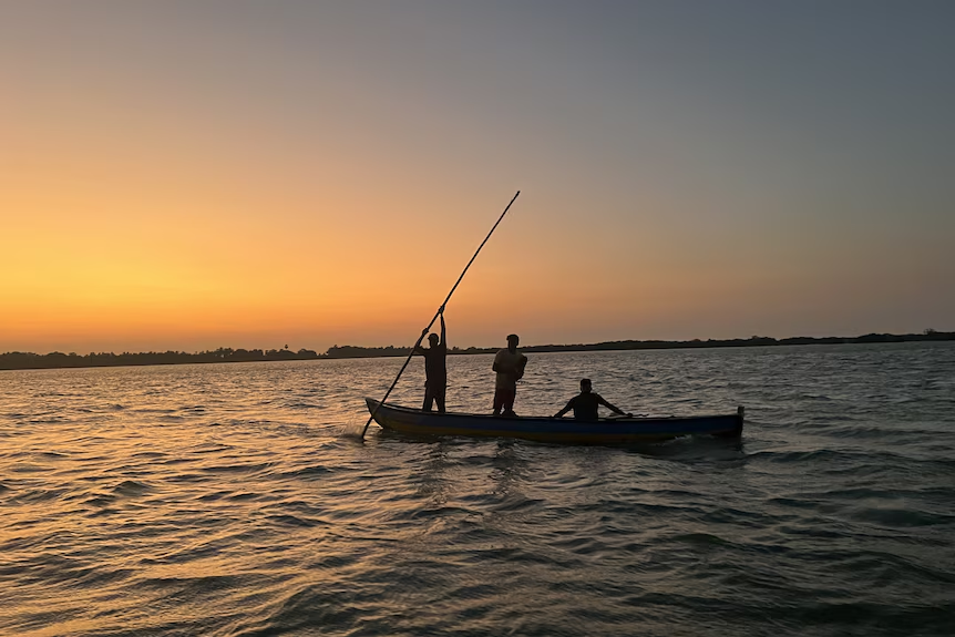
Fishermen returning home at sunset.(ABC Asia: Aanya Wipulasena)
A letter dated October 6, 2024 and addressed to President Anura Kumara Dissanayake, calls for urgent intervention to protect the coast.
“In Keerimundalam village, there is a 211-year-old church, 50 houses built by the state, a sub-post office, and an electricity transformer. While villagers have worked hard to protect these, their fishing activities have been affected,” the letter points out.
Keerimundalam today, at risk of complete erasure.(ABC Asia: Aanya Wipulasena)
In reply, senior assistant secretary to the president W.M. Bathiya Wijayaratne wrote an official letter asking the District Secretary to present the villagers’ appeal to the next coordination committee and provide a “quick” solution.
Mr Dias said there had been no reply to this letter. He said he was observing the sea claiming the village, and with it, his people’s lifestyle, identity, and culture.
Santhi, one of the oldest remaining villagers in Keerimundalam. (ABC Asia: Aanya Wipulasena)
The villagers are keen to have discussions with relevant authorities. They worry that their calls are not heard.
When discussions around climate change often take the form of economic impacts, it is crucial for authorities to listen to the profound human stories behind the numbers and to address their concerns, Mr Dias and Mr Fernando said.
Vinisious Obrey Fernando’s sister with his first-born in front of his father’s house, now washed away in the sea.(ABC Asia: Aanya Wipulasena)
When he finds time, Mr Fernando still goes to where his family’s house once was in Keerimundalam. Following in his father’s footsteps, he is the area postman. The post office has now shifted to the abandoned school building after the original building was damaged by the sea.
Often, he wishes he could return to his village. Many houses are submerged, out of sight.
Now, the sea levels have reached the churchyard.
“If the church goes to the sea, there will no more be a village there, and that is my biggest worry.”
This story was produced under the CIR- CANSA Media Fellowship Programme. It was originally published in ABC on 06 March 2025.
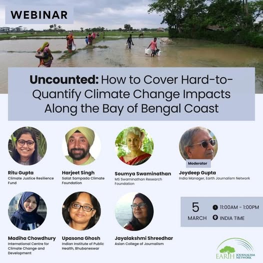
Earth Journalism Network is holding a webinar on those impacts of climate change that are not counted and rarely included in policy responses. Such impacts include those on physical and mental health, loss of biodiversity and ecosystem services, forced migration, forced closure of schools and colleges turned into cyclone or flood shelters etc.
We’re going to look at these impacts along the Bay of Bengal coast at a webinar from 11 am to 1 pm India time / 11.30 am to 1.30 pm Bangladesh time on Wednesday March 5.
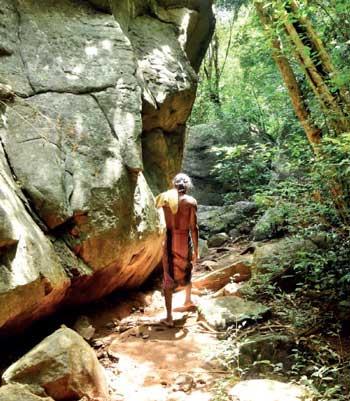
For Danigala Mahabandalage Suda Wannila Aththo, the incumbent leader of the Rathugala adivasi community, bee-honey harvesting is part of their traditional lifestyle. Rathugala is a scenic village in the Eastern Province of Sri Lanka, located bordering the Gal Oya region in Ampara District. Following a prayer dedicated to Kalu Bandara deiyo, a local deity whom they believe is a guardian of the thick jungles they live in, Suda Wannila Aththo and his group would carefully advance into the jungles, in search of bee hives, usually located atop steep cliffs. Unlike in the past, the chances of returning with a bounty of bee honey is rare as this forest-dwelling tribe faces multiple challenges to collect bee honey. Amongst them are a long list of government regulations that prohibit them from entering jungles and a decline in honeycombs due to loss of pollinator habitats largely due to climate change impact.
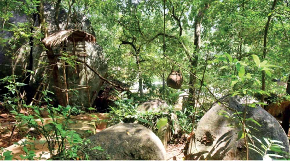
Image – A display at the Rathugala Vedda Heritage centre underscores the risks associated with wild bee honey harvesting Image Credits – Kithsiri De Mel/ Daily Mirror
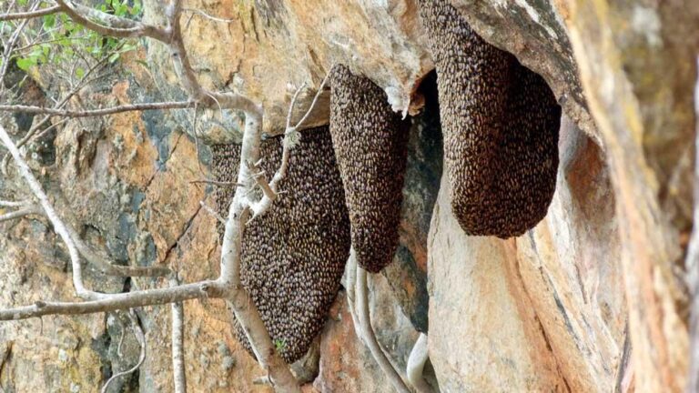
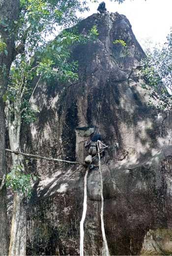
A fading tradition Traditional bee honey harvesting is a risky occupation. According to Charles Gabriel Seligmann’s book titled ‘The Veddas’, published in 1911, bee honey harvesting was once referred to as a ‘game’ where young boys in a tribe are taught to extract honeycombs without getting stung. They would initially set fire to some leaves beneath them as they believe that the smoke would chase away the honeybees (Apis cerana). The boys would then suspend themselves with a ladder made of creepers to slowly carve out the honeycomb off the rock using a tool known as the masliya, a stout stick about two and a half metres long with four prongs at one end, which the adivasi carries hanging by a loop from his forearm and which he uses to detach the comb and convey it into the maludema, the vessel that is used for collecting honeycombs. The thrill of bee honey collecting on an onlooker hasn’t changed (much) from how Seligmann, a lecturer in ethnology at the University of London described it from a first-hand experience. But today, this traditional practice is coupled with multiple challenges that have restricted the Rathugala adivasi community to a limited area within their home ground.
One of the earliest references to the adivasi community (previously known as Veddas) was by Robert Knox. In his accounts in 1681 believed to be the first accurate description of the Veddas, Knox describes a peculiar way in which they store venison. “They cut a hollow in a tree, put honey, fill it with flesh and stop it with clay,” it reads.
The Rathugala adivasi community is considered among the last remaining forest-dwelling people of Sri Lanka, carrying with them a rich cultural heritage. According to a 2023 research by the Centre for Policy Alternatives (CPA), the adivasi community lost some of their best hunting grounds and caves which were inundated by the Senanayaka Samudraya built as part of the Gal Oya Irrigation Scheme between 1949 and 1952. Since then, their traditional lands were destroyed and some of these lands were declared as catchment areas of the reservoirs, banning their hunter-gatherer practices.
Image – Various rituals are being done to seek permission from local deities, Image Credit – Daily Mirror
“Back in the day we used to walk freely in these jungles and collect bee honey for our daily requirements,” Suda Wannila Aeththo told the Daily Mirror during our visit to the Rathugala Vedda Heritage Centre situated along B562 (Bibile-Ampara road). “Today, we observe serious changes in these environments. The jungles of yesteryear were so rich in diversity. There were various native plants which we used for medicine and food. We didn’t have to worry about food, and it wasn’t costly like today,” said Suda Wannila Aeththo.
Image – Rathugala adivasi tribe is now restricted to a limited space and are unable to go hunting or collect bee honey due to government regulations and climate change, Image Credit – Daily Mirror
Bee honey harvesting was more of a cultural practice, he said. “If a girl is of marriageable age, the potential partner would carry honey, dried venison and other cultural gifts to express his interest in marrying her. But today, it has become difficult to collect bee honey. One reason is the existing government regulations: many of these jungles are now designated as forest reserves. Another reason: there are less suitable trees for pollinator insects like bees to thrive on. We find more invasive plant species such as lantana spreading rapidly, dominating the space required for native species. Many native plant species such as Bin Kohomba (Munronia pinnata) have become so rare that we doubt whether such plant species have already become extinct,” he added. According to the 2020 National Red List Bin Kohomba falls under the Endangered list of medicinal plants.
Rapid forest degradation
Pollinator insects such as bees and butterflies play a crucial role in ensuring food security, globally. Sri Lanka is home to nearly 150 species of bees—and four of them produce their own honey. Amongst them, the Asian honeybee (Apis cerana) is the most common species. However, bee researchers observe changes in bee populations due to rapidly diminishing forest cover.
“With rapid human population and the progressive denudation of forests in the past few centuries, bee honey production from natural forest reserves has been rapidly declining,” writes Dr. S. P. R Weerasinghe, Director of Agriculture in Dr. R. W. K Punchihewa’s book ‘Beekeeping for Honey Production’ published in 1994.
Sri Lanka is a signatory to the United Nations Framework Convention on Climate Change (UNFCC), ratified in November 1993 and was put into effect in March 1994. The 2017 Forest Level submission indicates that Sri Lanka has a forest cover of 29.1% thereby making a commitment to increase it to 32% by 2030 including forests as well as plantations.
People who engage in domestic bee honey production have started selling bee honey at nominal rates. So, we can’t charge a premium price. It’s a premium product because we provide authentic bee honey. Many of us are indebted. Some of us have even obtained bank loans. Back in the day we weren’t indebted to anyone when collecting bee honey. But things have changed – Suda Wannila Aththo, Leader of Rathugala Adivasi Community
There are around 20,000 species of bees around the world and Sri Lanka has around 150 species. We are particularly interested in the Asian honeybee (Apis cerana) – Dr. Anura Indrajith, Entomologist at Rajarata University
It is important to protect honeybees and wild bees because they are key pollinators in any ecosystem. Providing legal protection for honeybees will also put a halt on wild harvesting of bee honey which has a negative impact on their survival – Dr. Jagath Gunawardena, Senior Environmental Lawyer
Bee honey is used as a supportive material when preparing Ayurveda pharmaceuticals. It is used as a natural sweetener and a preservative as well. But there are two types of bee honey, the new and old and each one of these types has their own medicinal properties – Dr. Nirasha Gunaratne, Head, Department of Dravyaguna Vignana at Gampaha Wickramarachchi University of Indigenous Medicine
A 2001 study on forest policy trends in Sri Lanka indicates that the island’s natural forest cover decreased from 85-70 percent during 1881 to 1900, a time period which belonged to British rule of Ceylon. The central hills were cleared for export crop plantations, while the dry zone forests were logged for valuable timber. After the country gained independence in 1948, 2.9 million hectares (44 percent of the total land area) were still under forest cover (Dissanayake et al., 1983). By 1981 forest cover had been reduced to 1.63 million hectares (85 percent of total land area), representing a decrease at the rate of 50,000 hectares per year (Bandarathilleke, 1991).
Pollination crisis
A 2023 study on forest cover and natural vegetation loss shows that in 2000, 61.38 percent of the country had above 25% canopy density. But by 2020, the forest cover of these areas decreased by 52.78 percent. Data gathered during this study shows that the forest cover density in Anuradhapura, Kurunegala and Monaragala districts remain at 12.06%, 9.82% and 8.49% respectively.
A decline in forest cover also means a decline in potential pollinator habitats. The Intergovernmental Panel on Climate Change (IPCC) in its special report on Global Warming shows that climate change directly contributes to the loss of insects’ habitats.
According to Dr. Anura Indrajith, Entomologist at Rajarata University, one of the persisting issues is the lack of data on the number of natural honeybee colonies in the country. “There are around 20,000 species of bees around the world and Sri Lanka has around 150 species. We are particularly interested in the Asian honeybee (Apis cerana). Ten years ago, if we wanted to find a honeybee colony, we would go to a forest area. But nowadays it’s very difficult to find natural honeybee colonies. The European honeybee (Apis mellifera) can be found in the West,” said Dr. Indrajith.
Dr. Indrajith also noted a declining trend of giant honeybee (Apis dorsata) populations. However, bee researchers are challenged with lack of data to give an accurate estimation of the decline. He said that in Germany for instance, honeybee colonies have declined by 57% over the last 15 years. In UK it is 61% and India has experienced a 30% decline in past 25 years.
Climate change impacts on Asian honeybee
So far the Asian honeybee has been managed in its native ranges within South and East Asia. The reasons for the decline in natural honeybee colonies are manifold. “Bees and plants have a close relationship. If the flowers are not available due to heavy rain or drought there will be a scarcity of food for the honeybees and the population will experience a decline. During the drought (around August), there aren’t many flowers even on ornamental plants. Bees also need water. If there’s no water source around, they experience a lot of stress. On the other hand, during deforestation, they may not find enough nesting sites. As a result, they will go deeper into the jungles or away from the area,” Dr. Indrajith explained.
Honeybees are also prone to pests and diseases in the face of climate change. Studies indicate that warmer falls allow the varroa mites season to last longer. “In addition, honeybees are also threatened by wax moths that increase with changing climatic conditions. Even though the Asian honeybee is resistant to most pests and diseases, it’s smaller in size when compared to the European honeybee and is less adaptable to climate change,” Dr. Indrajith added.
As told by Suda Wannila Aththo earlier, climate change is one factor that fosters the growth of invasive species such as lantana, Guinea grass (Megathyrsus maximus) which further compromise pollination patterns of pollinator insects. When invasive plants overrun native plants and establish a monoculture, the area may be more susceptible to wildfires or pests. This phenomenon may intensify the effects of climate change on humans and the environment.
A 2023 study on beekeeping under climate change indicates that the brood-free period for colonies will likely be shorter or even completely absent due to raising temperatures. This will cause a negative feedback loop, which will increase the impact of pests depending on the brood for their reproduction.
Demand for pure bee honey
Pure bee honey also includes various health benefits in traditional schools of Sinhala medicine including Hela Vedakama and Deshiya Chikitsa in addition to Ayurveda and Unani schools of medicine. “According to Ayurveda textbooks, there are various types of bee honey depending on the color, the type of bee that produces the honey and various other factors,” said Dr. Nirasha Gunaratne, Senior lecturer in Ayurveda Pharmaceutics and Head, Department of Dravyaguna Vignana at Gampaha Wickramarachchi University of Indigenous Medicine. “According to Charaka Samhita, a Sanskrit text in Ayurveda medicine there are four types of bee honey whereas the Sushruta Samhita mentions eight varieties. Bee honey is used as a supportive material when preparing Ayurveda pharmaceuticals. It is used as a natural sweetener and a preservative as well. But there are two types of bee honey, the new and old and each one of these types has their own medicinal properties,” explained Dr. Gunaratane.
Dr. Gunaratne explained that ‘new bee honey’ includes Vrumhana Guna (properties that nourish the body), properties to increase energy and strength while enhancing nutritional support for three bio energies in the body (Vatha, Pitha, and Kapha) in addition to laxative effects. “Old bee honey on the other hand supports anti-diarrheal actions, controls obesity and has more medicinal properties than new bee honey,” she explained while adding that it also includes anti-diabetic properties.
But she warned that pure bee honey is slowly becoming a rarity in the market. With adulterated bee honey, it has become a challenge to obtain pure bee honey that’s prescribed for patients. But there are several parameters to check if a bee honey sample has been adulterated. “There are simple tests such as adding a teaspoon of bee honey into a cup of water. If the honey settles at the bottom, it is pure. Adulterated bee honey would mix with water without a trace. Then there’s a flame test. You can simply soak a wick in bee honey and burn it. If its pure bee honey, the flame would spread. Adulterated bee honey has a certain percentage of moisture, and the flame would go out. A blot test is where you add a drop of bee honey on a tissue paper and firmly squeeze it. There would be some moisture if the sample has been adulterated. Another way to check for adulterated bee honey is to add a drop of bee honey onto your thumb. If it moves, then the sample is adulterated,” Dr. Gunaratne said, adding that patients should always look for pure bee honey in the market.
Sustainable beekeeping – The way forward?
Bee researchers such as Dr. Indrajith argue that traditional bee honey collecting methods would hinder the sustainability of honeybee populations as collectors would crush honeycombs to extract all honey. This would pose a threat to larvae and young stages of growth inside the honeycomb that could ideally develop into the next colony of honeybees.
From a state level, the primary measure for the conservation of honeybees is the Pollinator Conservation Action Plan (PCAP) which was put forward by the Ministry of the Environment in 2012. However, this conservation policy is not specific to bees and takes into consideration all insects which are categorised as pollinators. But, there is no legal protection for the honeybee.
“All Lepidoptera including butterflies and moths are protected under the Flora and Fauna Protection Ordinance, but not honeybees or wild bees,” said Senior Environmental Lawyer Dr. Jagath Gunawardena. “But it is important to protect honeybees and wild bees because they are key pollinators in any ecosystem. Providing legal protection for honeybees will also put a halt on wild harvesting of bee honey which has a negative impact on their survival.” He further said that the Pollinator Conservation Action Plan never saw light of day.
In this backdrop, bee researchers are pushing for improved beekeeping education while encouraging domestic bee honey production. The breeding of resistant bee strains that are more adaptable for climate change has been discussed.
Dr. Indrajith further noted that without depending on wild colonies, methods to multiply by artificially rearing the queen bee could be developed. “Some bees are productive and some are lethargic. After finding a good strain of bees we can multiply them in the lab,” he said while adding that shelters could be provided for solitary bees that don’t join colonies.
Initiatives to introduce apitourism – an extension of ecotourism, are being discussed to make sustainable beekeeping popular among Sri Lanka’s ecotourism niche.
Today, adivasi tribes must bear a heavy cost when entering the jungles to collect bee honey unlike in the past. It would cost anything between Rs. 10,000-15,000 for a group of 5-6 individuals to go into the thick jungles in search of bee hives and honeycombs. Unlike in the past, adivasi tribes are unable to hunt and a huge expense is borne on food. They stay in the jungles for 5-6 days or sometimes even longer to obtain a good yield. “On most days we come back empty-handed. During the season we can collect around 50-60 bottles. But we are unable to even cover the production cost. The market price fluctuates because people who engage in domestic bee honey production have started selling bee honey at nominal rates. So, we can’t charge a premium price. It’s a premium product because we sacrifice our blood and sweat to provide authentic bee honey to people. Many of us are indebted. Some of us have even obtained bank loans. Back in the day we weren’t indebted to anyone when collecting bee honey because it’s part of our tradition. But things have changed,” Suda Wannila Aththo said, adding that perhaps in time to come their community too would have to adjust to modern methods of bee honey production as it has now become a costly process.
This story was produced under the CIR- CANSA Media Fellowship Programme. The It was originally published in Daily Mirror on 19 February 2025.
In a joint letter to the president, 25 media rights-based organizations, media collectives and civil society organizations in Sri Lanka request for accountable and responsible involvement of the government to uphold the press freedom and the right to freedom in expression in the country. As a signatory of the joint letter, the Center for Investigative Reporting (CIR) looks forward for timely actions by the government on the claims made by the request. The joint letter is given below.
The Centre for Investigative Reporting (CIR) and Strengthening Social Cohesion and Peace in Sri Lanka (SCOPE) recently hosted a workshop on gender-based violence and women’s political engagement for a group of women journalists.
The workshop titled Towards New and Inclusive Narratives was held on 3 December 2024 at the Mount Lavinia Hotel.
The workshop consisted of two panel discussions, a round table discussion, an experience-sharing session and a segment to develop recommendations to counter GBV and promote nondiscriminatory media.
The first panel titled ‘Lessons from 2024 elections: Defying GBV in politics’ looked at women representation in politics and new trends and featured Kanaka Abeygunawardana, Convener, Gender and Election Working Group (GEWG), Gagani Weerakoon, Associate Editor, Ceylon Today, and Nabeela Iqbal, Head of Operations/Founder, Sisterhood Initiative.
The second panel, titled ‘Media, Social Media, and GBV: A Critical Analysis’ looked at the role of media and social media in the context of increasing gender-based violence in the media, especially, technology-facilitated GBV. Hana Ibrahim, Editor of Daily/Weekend Express and Convenor of the Free Media Movement (FMM), and Radika Gunaratne, Founder/ Executive Director, Parivartan, lawyer and activist were the speakers.
Dilrukshi Handunnetti, CIR’s Director/ Co-Founder facilitated the day’s proceedings.
Over 25 mid-career and senior journalists attended the program and collectively developed recommendations to be proposed to identified stakeholder groups.
‘Towards New and Inclusive Narratives,’ a workshop on GBV and women’s political participation organized by the Center for Investigative Reporting (CIR) in collaboration with Strengthening Social Cohesion and Peace in Sri Lanka (SCOPE) will be held on 03 December 2024 at the Mount Lavinia Hotel.
There are deep-rooted structural barriers that prevent women’s political participation. Multiple forms of gender- based discrimination, violence against women including online harassment/ violence form part of the roadblocks that perpetuate patriarchy in political structures and exclude women’s entry. Active participation and continuity. This also denies women both their right to political participation and representation, in return, causing the systems to lose women’s contribution towards governance and policy formulation.
Media plays an influential role in shaping public opinion. Media can contribute towards greater awareness on the need to counter all forms of discrimination and gender-based violence (GBV) through the promotion of inclusive and alternate media narratives, while increasing women’s voices in the media and promoting greater opportunity for women’s engagement in politics.
The workshop intends to increase the understanding of GBV, structural barriers to women’s political participation and explore the role journalists can play in introducing inclusive and alternate media narratives.
Al comparar casinos en línea, teniendo en cuenta la variedad de juegos, pensando en un uso regular, una plataforma que puede revisarse de forma independiente es chicken subway juego , mientras una revisión independiente también puede abarcar la experiencia móvil y la navegación, junto con las reglas de retirada y los límites antes de registrarse.
Vor der Entscheidung, welche Seite näher geprüft werden soll, beim Vergleich von Navigation und Bedienkomfort, als Teil eines unabhängigen Vergleichs, eine Option für den direkten Vergleich ist fugu casino 5 , separat kann man auch betrachten die aktuellen Aktionsbedingungen, zusammen mit den wichtigsten Bedienungsdetails ohne die endgültige Wahl zu überstürzen.
Før man beslutter hvilken side der bør undersøges nærmere, ved vurdering af mobil brug, fra et praktisk brugerperspektiv, en platform der kan vurderes uafhængigt er https://spinlander-casino.dk/ , mens en uafhængig vurdering også kan omfatte registrerings- og verifikationsprocessen, med kundesupportens tilgængelighed i tankerne uden at forhaste den endelige beslutning.
Dla użytkowników zestawiających kilka platform jednocześnie, z uwzględnieniem metod wpłat i wypłat, na potrzeby wstępnej oceny, jednym z punktów odniesienia może być kasyno na prawdziwe pieniadze jeśli jednocześnie ocenia się najważniejsze warunki korzystania z serwisu, wraz z zasadami dotyczącymi wypłat w ramach szerszego porównania podobnych serwisów.

 The endemicity of the dengue virus has increased since 2000. Therefore the number of cases cannot be brought down to zero even during a drought period. Due to the tropical climate the incidence of dengue is high and there is high transmissibility
 The temperature highs, the air quality highs and evaporation has been exacerbated due to the already observed climate change. The argument that the warmer atmosphere has the capacity to hold much greater amounts of water vapour is sound and when large clouds burst it can lead to extreme rainfall